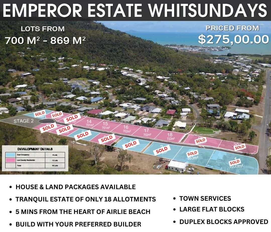
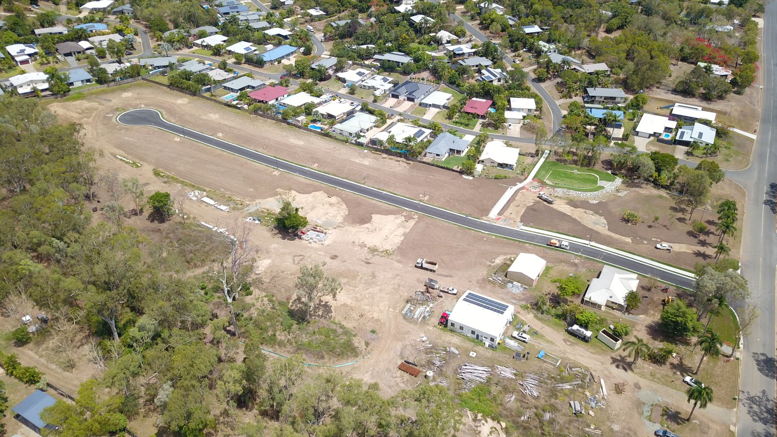
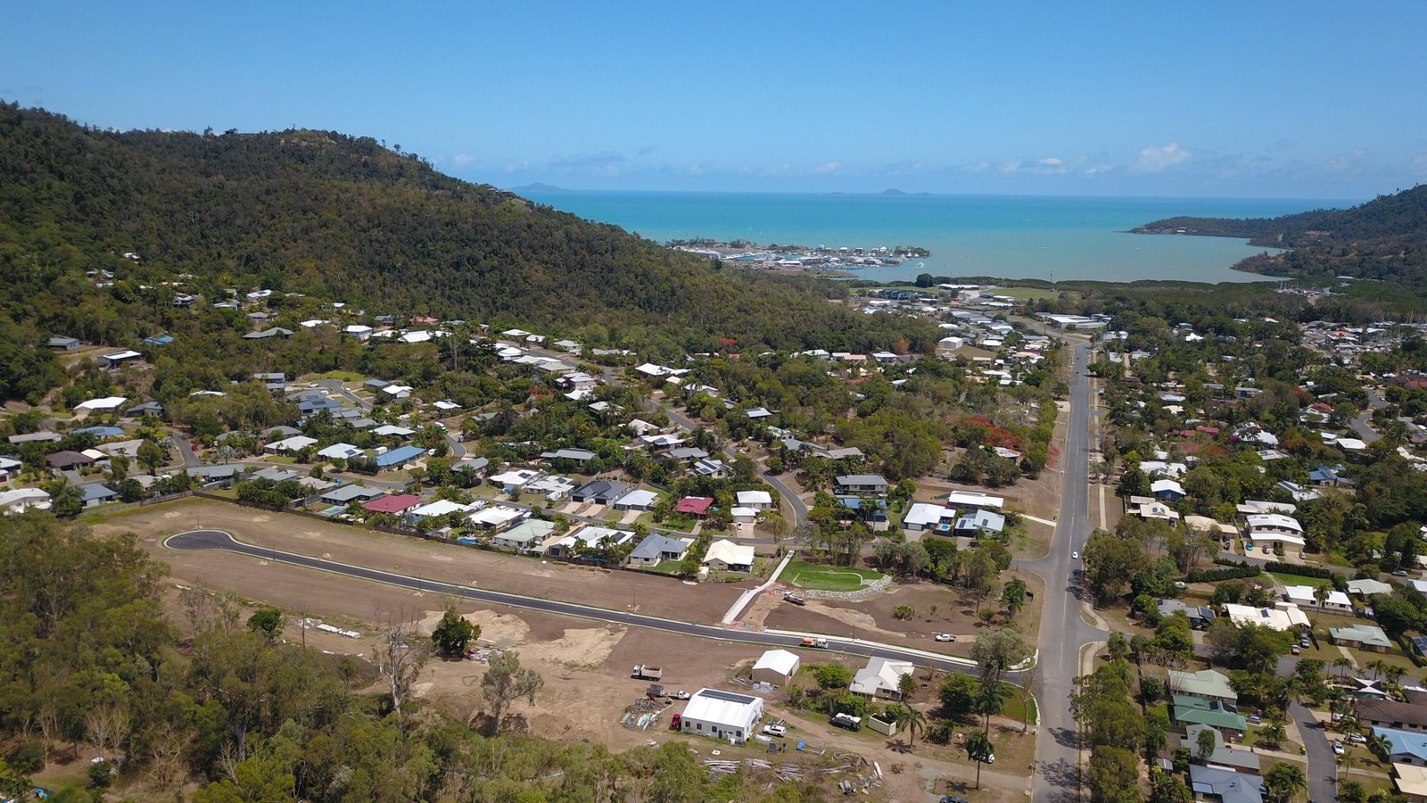
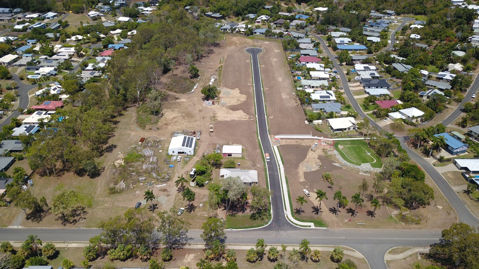
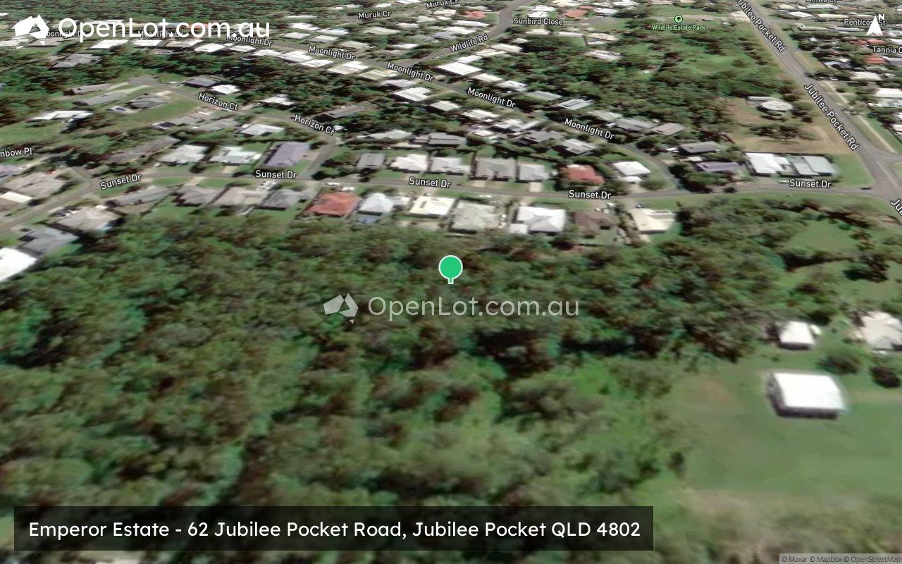
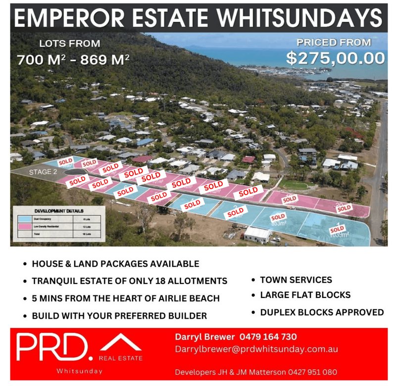
Emperor Estate - Jubilee Pocket
This information is estimated by the OpenLot research team. Let us know here to provide up-to-date information about this development.
| Total new homes | 18 |
| Area size | 2.01 hectares |
| City council | Whitsunday Regional Council |
| Developer | N/A |
| Project marketer | PRD Whitsunday |
Land for Sale, House and Land Packages:
Popular Estates near Emperor Estate - Jubilee Pocket


 3
3  2
2  2
2


Updates for Emperor Estate - Jubilee Pocket
Facebook updates:
Submit the Facebook page for Emperor Estate - Jubilee Pocket.
Related news:
Emperor Estate 62 Jubilee Pocket Road, JUBILEE POCKET. Fully flat land ready to build shortly Residential for Sale. Flat land for Sale Listed by PRD.
Missing articles? Send us a link here.
Location & Map for Emperor Estate - Jubilee Pocket
Vacancy Rate in Jubilee Pocket QLD 4802
View full vacancy rate history in Jubilee Pocket QLD 4802 via SQM Research.
Schools near Emperor Estate - Jubilee Pocket
Here are 6 schools near Emperor Estate - Jubilee Pocket:
Prep-6 Government Primary School
Prep-12 Independent Combined School
Prep-12 Catholic Combined School - School Head Campus
7-12 Government Secondary School
Prep-6 Government Primary School
Prep-6 Government Primary School
Reviews & Comments on Emperor Estate - Jubilee Pocket
Estate Brochure, Masterplan, Engineering Plan, Plan of Subdivision (POS), Design Guidelines
FAQs about Emperor Estate - Jubilee Pocket
View all estates marketed by PRD Whitsunday
- Cannonvale State School - 3.1km north-west
- Whitsunday Christian College - 5.3km west
- St Catherine's Catholic College The Whitsundays - 19.6km south-west
- Proserpine State High School - 20.0km south-west
- Proserpine State School - 20.2km south-west
- Hamilton Island State School - 24.5km east
Popular Estates near Emperor Estate - Jubilee Pocket
Latest New Home Articles for You

19/Aug/2025 | OpenLot.com.au
🏡 Suburb Profile: Beveridge
19/Aug/2025 | OpenLot.com.au
test
19/Aug/2025 | OpenLot.com.au
tests

13/Jun/2025 | OpenLot.com.au
Display Homes at Playford Alive Estate: A Thriving Community at the Heart of Munno Para
Welcome to Playford Alive, a vibrant and dynamic masterplanned community ...

11/Jun/2025 | OpenLot.com.au
Display Homes at Ocean Hill Estate: A Thriving Community by the Coast
A short stroll from the white sands of Madora Beach and fringed by the co...

10/Jun/2025 | OpenLot.com.au
Display Homes at Bluestone Estate: An Established Community in the Mount Barker
Whether you’re a first home buyer, a growing family, or looking to downsi...

09/Jun/2025 | OpenLot.com.au
Queensland Leads, But NSW and VIC Fall Behind, in New Housing Buyer Demand Index
New data reveals that Australia’s new housing market remains resilient de...

06/Jun/2025 | OpenLot.com.au
Display Homes at Minters Fields Estate: A Scenic Hillside Community in Mount Barker
Nestled in the heart of Mount Barker, Minters Fields offers a truly remar...

03/Jun/2025 | OpenLot.com.au
🏡 Step Inside a Frenken Home at Smiths Lane
During a recent visit to the Smiths Lane display village, OpenLot.com.au ...