The Reserve Estate - Eight Mile Plains
This information is estimated by the OpenLot research team. Let us know here to provide up-to-date information about this development.
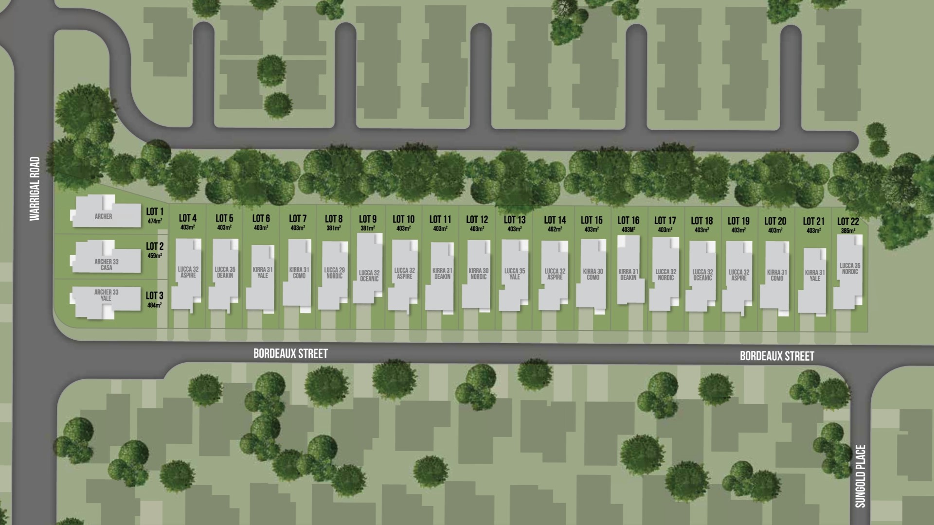
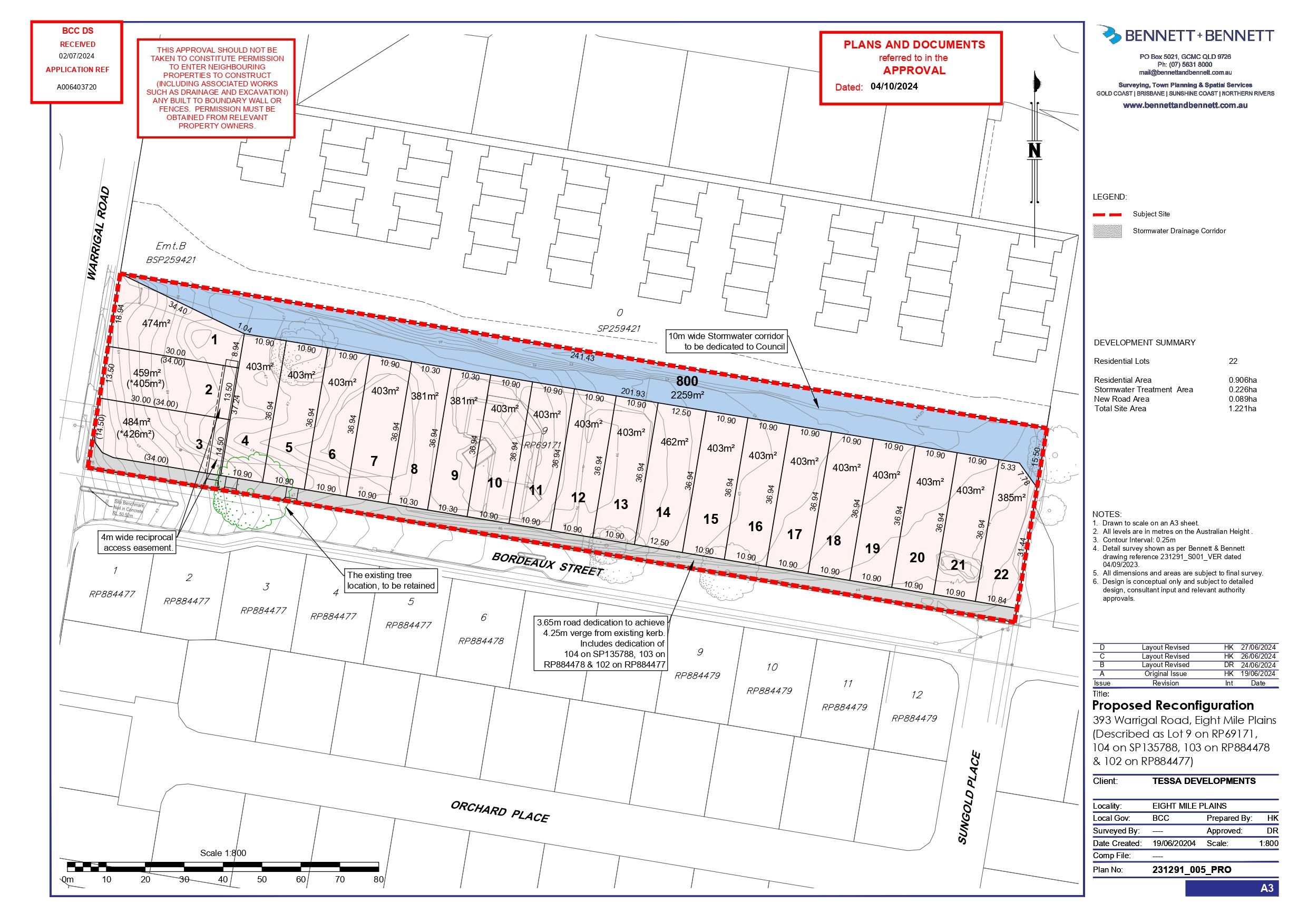
| Total new homes | 22 |
| Area size | 1.21 hectares |
| Growth Region | Greater Brisbane Growth Areas |
| City council | Brisbane City Council |
| Developer | Metricon |
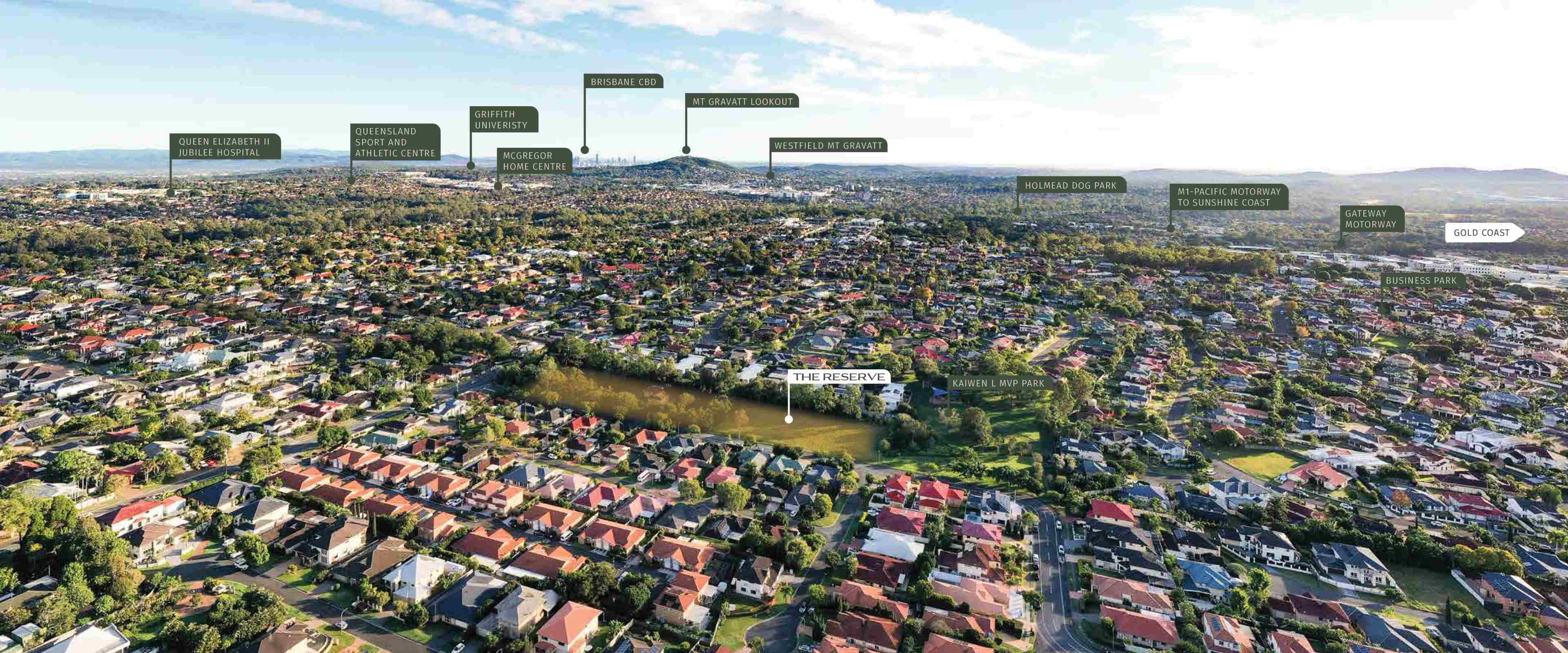
| Distance to | Brisbane CBD - 14 km south-east Brisbane Airport - 21 km south Gold Coast CBD - 57 km north-west |
House and Land Packages:
Popular Estates near The Reserve Estate - Eight Mile Plains


 4
4  2
2  2
2


Updates for The Reserve Estate - Eight Mile Plains
Facebook updates:
Submit the Facebook page for The Reserve Estate - Eight Mile Plains.
Related news:
Development.i provides access to past and current application details and basic property information for the Brisbane City Council Local Government area so it is easy to stay informed about what is happening in your area.
Browse Metricon's House & Land Packages at The Reserve in Armstrong Creek. Visit our website to browse designs and availability.
ProjX Australia is one of Australia’s fastest-growing project marketing firms, based in South East Queensland, with over 8 years of proven success in driving off-the-plan development sales.
Missing articles? Send us a link here.
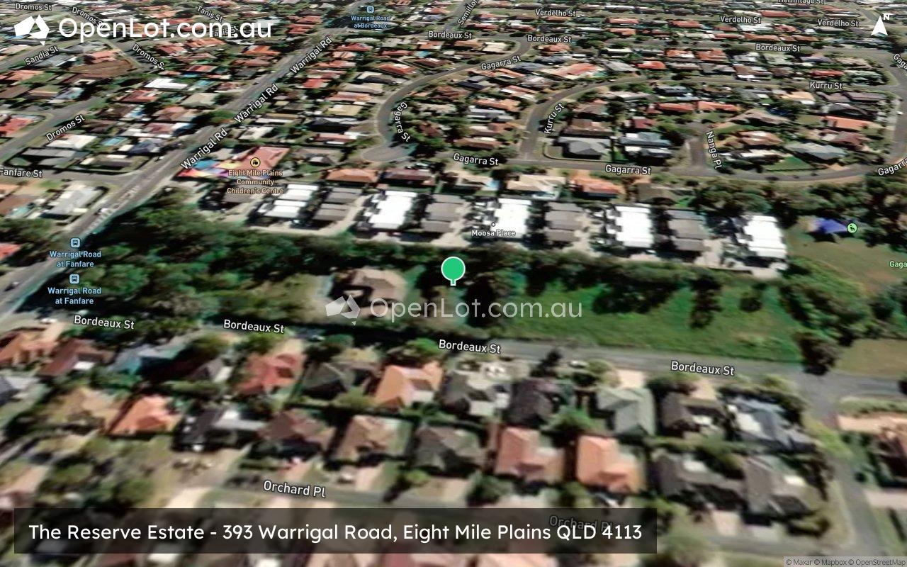
Location & Map for The Reserve Estate - Eight Mile Plains
Visit Display Homes near The Reserve Estate - Eight Mile Plains


Vacancy Rate in Eight Mile Plains QLD 4113
View full vacancy rate history in Eight Mile Plains QLD 4113 via SQM Research.
Schools near The Reserve Estate - Eight Mile Plains
Here are 6 schools near The Reserve Estate - Eight Mile Plains:
Prep-6 Government Primary School
7-12 Government Secondary School
7-12 Government Secondary School
7-12 Government Secondary School
Prep-6 Government Primary School
Prep-6 Government Primary School
Reviews & Comments on The Reserve Estate - Eight Mile Plains
Estate Brochure, Masterplan, Engineering Plan, Plan of Subdivision (POS), Design Guidelines
FAQs about The Reserve Estate - Eight Mile Plains
View all estates from Metricon
- Warrigal Road State School - 467m south-west
- Runcorn State High School - 1.4km south-west
- MacGregor State High School - 2.2km north-west
- Rochedale State High School - 2.4km east
- MacGregor State School - 2.4km north-west
- Eight Mile Plains State School - 2.4km south-east
Popular Estates near The Reserve Estate - Eight Mile Plains
Latest New Home Articles for You

19/Aug/2025 | OpenLot.com.au
🏡 Suburb Profile: Beveridge
19/Aug/2025 | OpenLot.com.au
test
19/Aug/2025 | OpenLot.com.au
tests

13/Jun/2025 | OpenLot.com.au
Display Homes at Playford Alive Estate: A Thriving Community at the Heart of Munno Para
Welcome to Playford Alive, a vibrant and dynamic masterplanned community ...

11/Jun/2025 | OpenLot.com.au
Display Homes at Ocean Hill Estate: A Thriving Community by the Coast
A short stroll from the white sands of Madora Beach and fringed by the co...

10/Jun/2025 | OpenLot.com.au
Display Homes at Bluestone Estate: An Established Community in the Mount Barker
Whether you’re a first home buyer, a growing family, or looking to downsi...

09/Jun/2025 | OpenLot.com.au
Queensland Leads, But NSW and VIC Fall Behind, in New Housing Buyer Demand Index
New data reveals that Australia’s new housing market remains resilient de...

06/Jun/2025 | OpenLot.com.au
Display Homes at Minters Fields Estate: A Scenic Hillside Community in Mount Barker
Nestled in the heart of Mount Barker, Minters Fields offers a truly remar...

03/Jun/2025 | OpenLot.com.au
🏡 Step Inside a Frenken Home at Smiths Lane
During a recent visit to the Smiths Lane display village, OpenLot.com.au ...