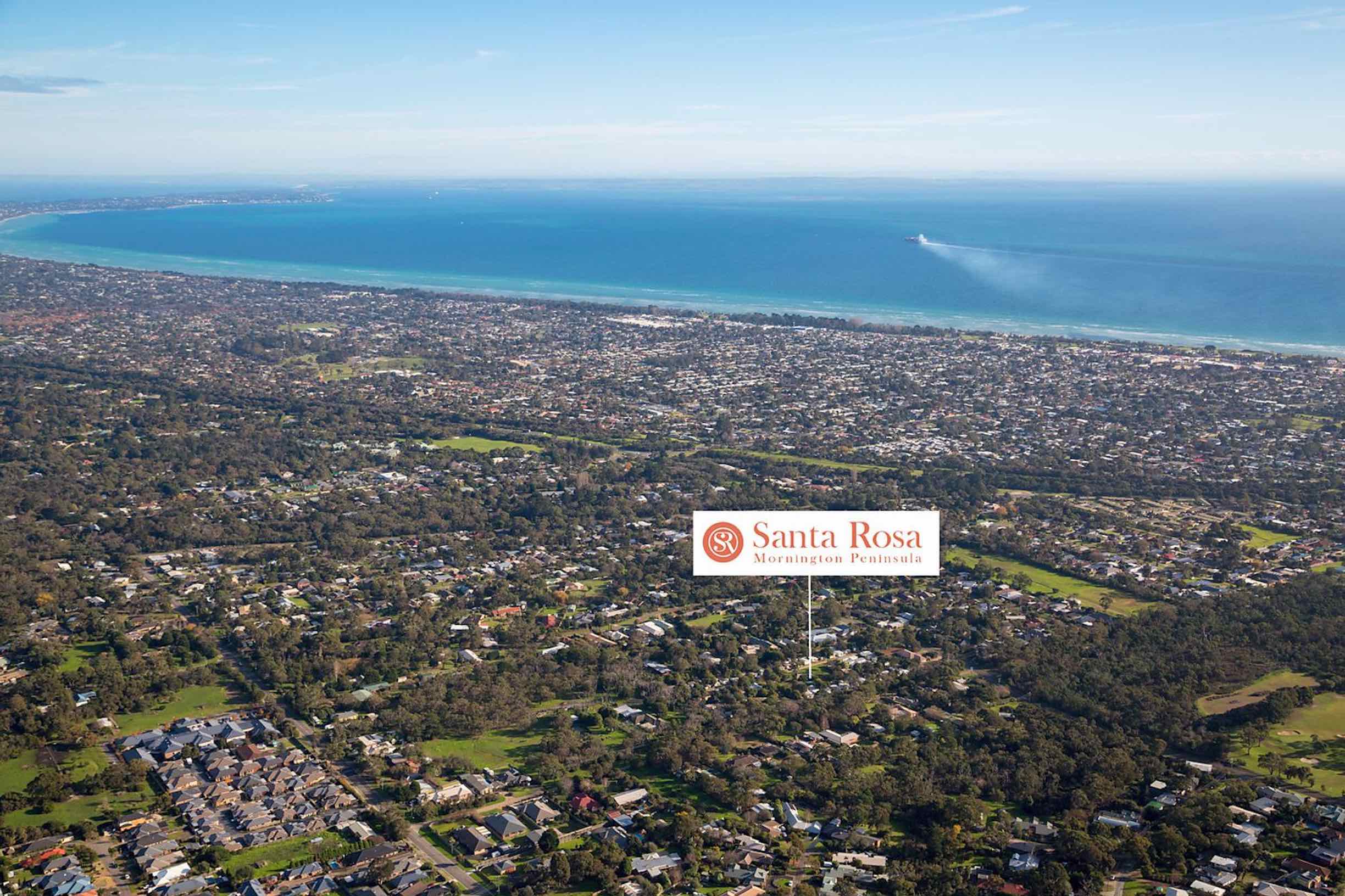
Santa Rosa Estate - Rosebud SOLD OUT
This information is estimated by the OpenLot research team. Let us know here to provide up-to-date information about this development.
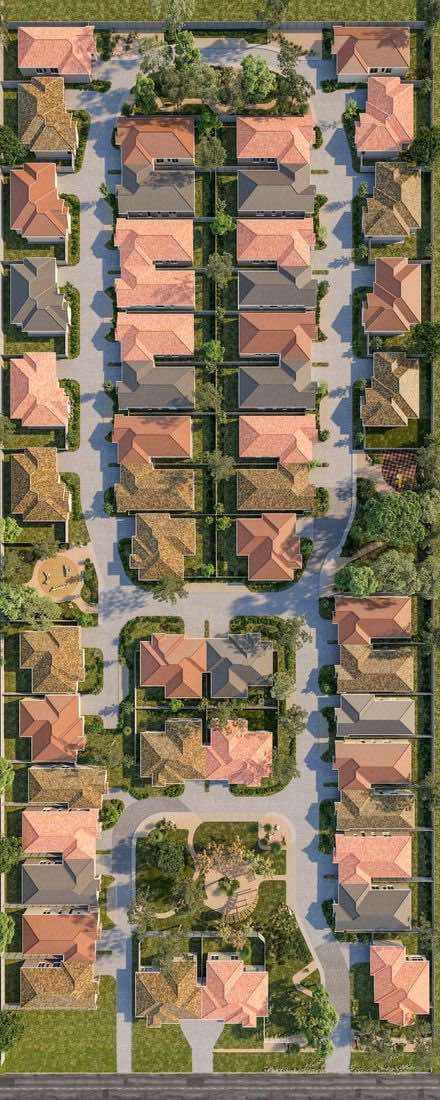
| Total new homes | 50 |
| Area size | 2.44 hectares |
| Growth Region | Melbourne South East Growth Corridor |
| City council | Mornington Peninsula Shire Council |
| Developer | Piermont Group, Mainline Developments |
| Other names | Carrington Caravan Park |
| Distance to | Melbourne CBD - 62 km south |
Land for Sale, House and Land Packages:
Popular Estates near Santa Rosa Estate - Rosebud


 3
3  2
2  2
2


Updates for Santa Rosa Estate - Rosebud
Facebook updates:
Related news:
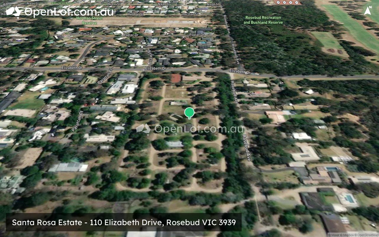
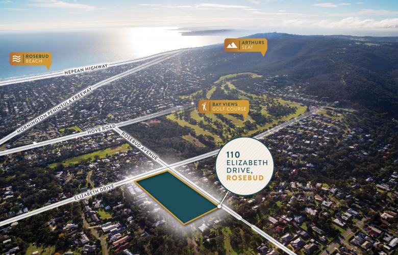
Land & Development Property Sold at 110 Elizabeth Drive, Rosebud VIC 3939. Significant Development Site in the Renowned Mornington Peninsula. See if it's right for you or find something similar at Commercial Real Estate.

Everything you need for 110 Elizabeth Drive Rosebud VIC 3939 all in one place, whenever you need it. For residents, owners committees and building teams.
The sale of a significant development site in Melbourne's Mornington Peninsula highlights the continued demand for prime landholdings with development upside throughout Victoria, Savills Australia says. Comprising 24,412 square metres, 110 Elizabeth Drive, Rosebud includes extensive dual street frontage on both Elizabeth Drive and Rosebud Avenue. The site benefits from convenient access to Mornington Peninsula Freeway, and offers a range of potential development outcomes (STCA) for the purchaser.
Santa Rosa Rosebud creates a wonderful place that you can call home. In the non-stop hustle and bustle of today’s lifestyle, Santa Rosa creates time.

Missing articles? Send us a link here.
Location & Map for Santa Rosa Estate - Rosebud
Land Price Trend in Rosebud VIC 3939
- In Oct - Dec 22, the median price for vacant land in Rosebud VIC 3939 was $600,000. *
- From Jan - Mar 18 to Oct - Dec 22, the median price for vacant land in Rosebud VIC 3939 has increased 46.23%. *
- From 2008 to 2022, the median price for vacant land in Rosebud VIC 3939 has increased 205.56%. *
Vacancy Rate in Rosebud VIC 3939
View full vacancy rate history in Rosebud VIC 3939 via SQM Research.
Schools near Santa Rosa Estate - Rosebud
Here are 6 schools near Santa Rosa Estate - Rosebud:
Prep-6 Catholic Primary School
Prep-6 Government Primary School
7-12 Government Secondary School
Prep-6 Government Primary School
11-12 Independent Special School - School Head Campus
Prep-6 Government Primary School
Reviews & Comments on Santa Rosa Estate - Rosebud
Estate Brochure, Masterplan, Engineering Plan, Plan of Subdivision (POS), Design Guidelines
FAQs about Santa Rosa Estate - Rosebud
View all estates from Piermont Group
View all estates from Mainline Developments
- Our Lady of Fatima School - 1.9km west
- Rosebud Primary School - 2.3km north
- Rosebud Secondary College - 2.8km west
- Eastbourne Primary School - 3.1km west
- Advance College of Education Incorporated - 3.1km west
- Boneo Primary School - 5.0km south-west
Popular Estates near Santa Rosa Estate - Rosebud
Latest New Home Articles for You

19/Aug/2025 | OpenLot.com.au
🏡 Suburb Profile: Beveridge
19/Aug/2025 | OpenLot.com.au
test
19/Aug/2025 | OpenLot.com.au
tests

13/Jun/2025 | OpenLot.com.au
Display Homes at Playford Alive Estate: A Thriving Community at the Heart of Munno Para
Welcome to Playford Alive, a vibrant and dynamic masterplanned community ...

11/Jun/2025 | OpenLot.com.au
Display Homes at Ocean Hill Estate: A Thriving Community by the Coast
A short stroll from the white sands of Madora Beach and fringed by the co...

10/Jun/2025 | OpenLot.com.au
Display Homes at Bluestone Estate: An Established Community in the Mount Barker
Whether you’re a first home buyer, a growing family, or looking to downsi...

09/Jun/2025 | OpenLot.com.au
Queensland Leads, But NSW and VIC Fall Behind, in New Housing Buyer Demand Index
New data reveals that Australia’s new housing market remains resilient de...

06/Jun/2025 | OpenLot.com.au
Display Homes at Minters Fields Estate: A Scenic Hillside Community in Mount Barker
Nestled in the heart of Mount Barker, Minters Fields offers a truly remar...

03/Jun/2025 | OpenLot.com.au
🏡 Step Inside a Frenken Home at Smiths Lane
During a recent visit to the Smiths Lane display village, OpenLot.com.au ...