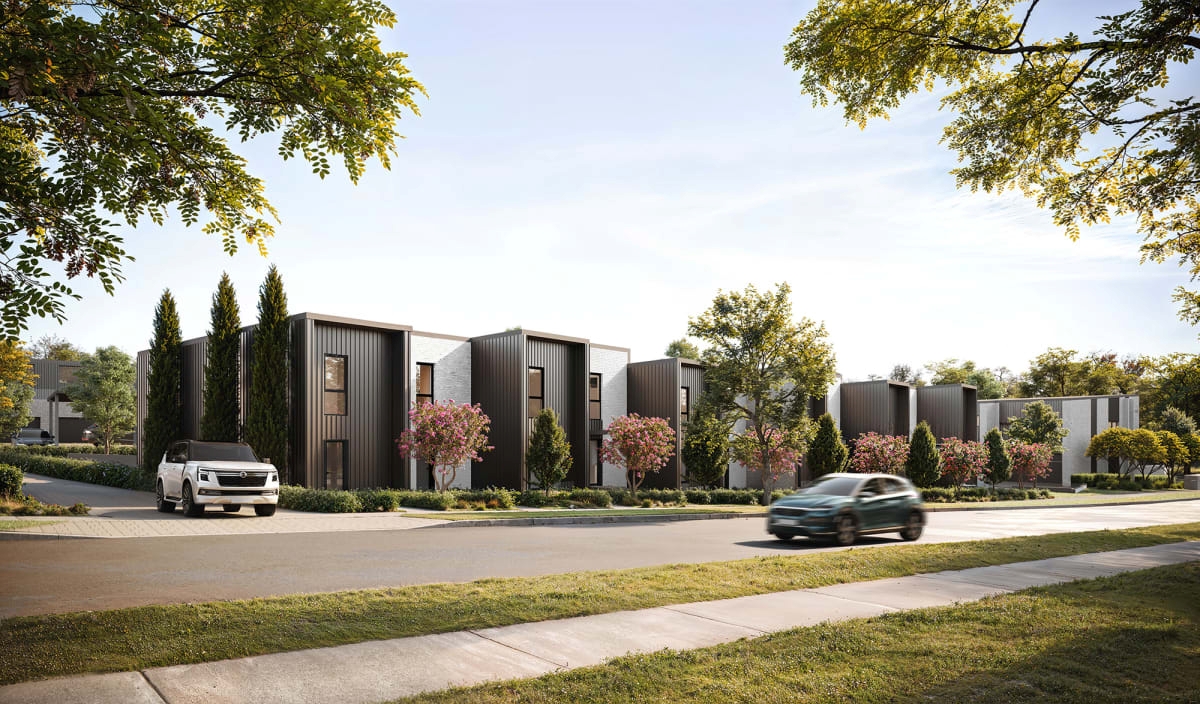
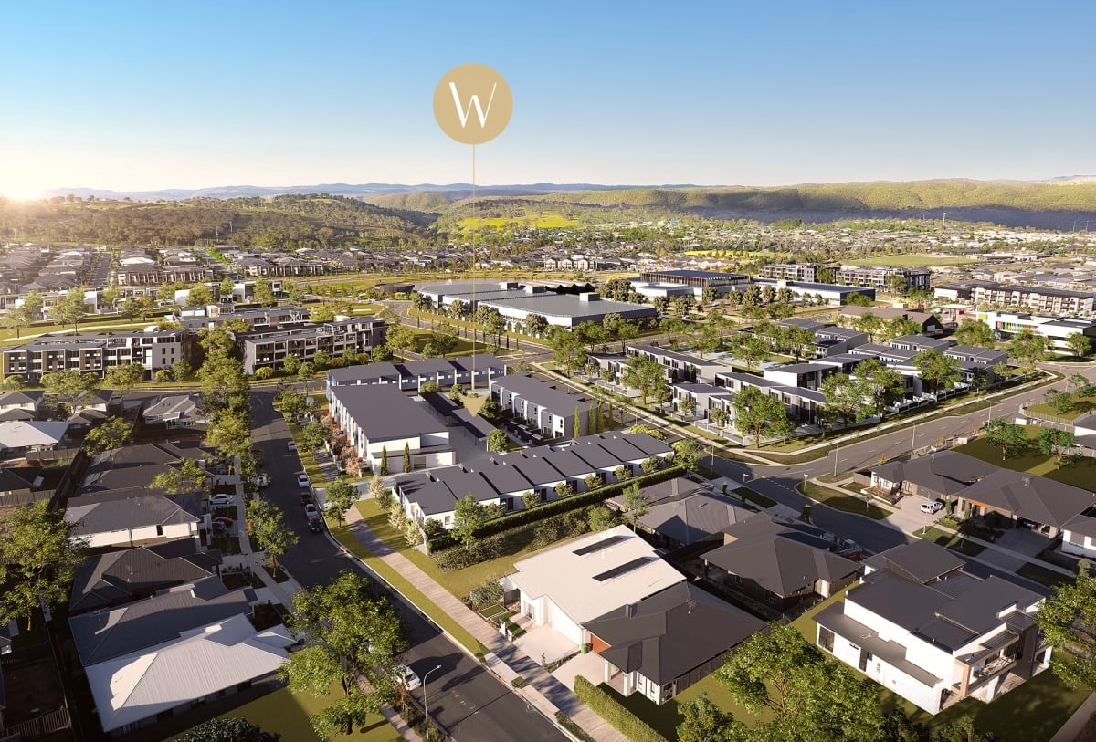
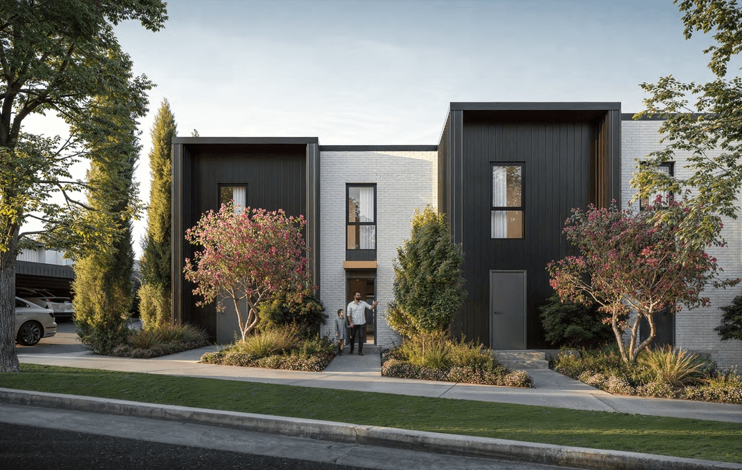
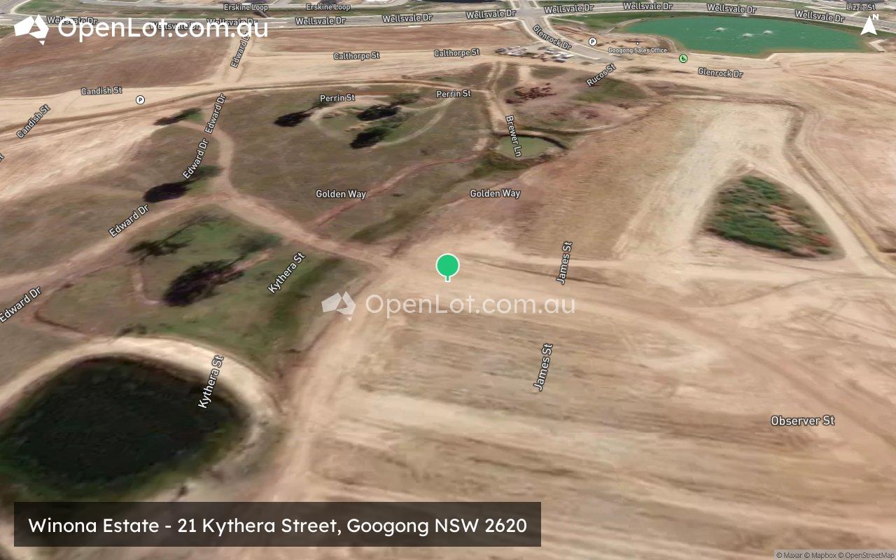
Winona Estate - Googong
This information is estimated by the OpenLot research team. Let us know here to provide up-to-date information about this development.
| Total new homes | 39 |
| Area size | N/A |
| Growth Region | Canberra Growth Regions |
| City council | Queanbeyan-Palerang Regional Council |
| Developer | Bronte Group |
| Distance to | Canberra Airport - 14 km south Canberra CBD - 16 km south-east |
Townhomes:
Popular Estates near Winona Estate - Googong


Updates for Winona Estate - Googong
Facebook updates:
Related news:
Missing articles? Send us a link here.
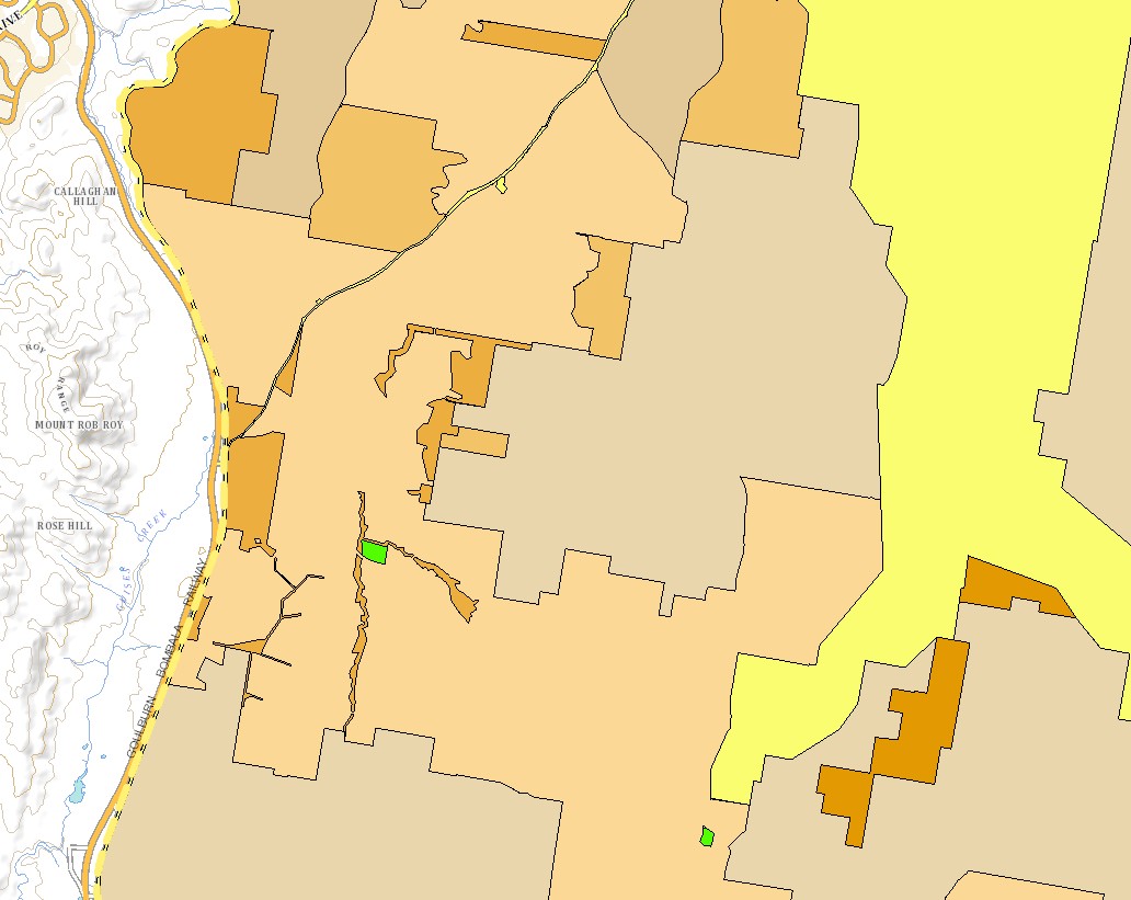
Location & Map for Winona Estate - Googong
Visit Display Homes near Winona Estate - Googong

Vacancy Rate in Googong NSW 2620
View full vacancy rate history in Googong NSW 2620 via SQM Research.
Schools near Winona Estate - Googong
Here are 6 schools near Winona Estate - Googong:
K-12 Independent Combined School
K-6 Government Primary School
K-6 Government Primary School
7-12 Government Secondary School
U Government Special School
K-6 Government Primary School
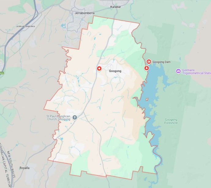
Suburb Planning Review in Googong NSW 2620
Googong is a suburb of approximately 780 hectares within the Queanbeyan-Palerang Regional Council, forming part of the Southern Tablelands region in New South Wales, located 10 km South of Queanbeyan, 16 km South East of Canberra and 298 km South West of Sydney CBD.
The township of Googong occupies an area of 780 hectares, with the origins of its name unknown and the occupied by early European settlers of the Canberra region in 1845. he name Googong is believed to be derived from Aboriginal origins, possibly referencing "good water" or "plenty of water," a nod to the area's early use for farming and its proximity to Googong Dam, a vital water catchment for the region.
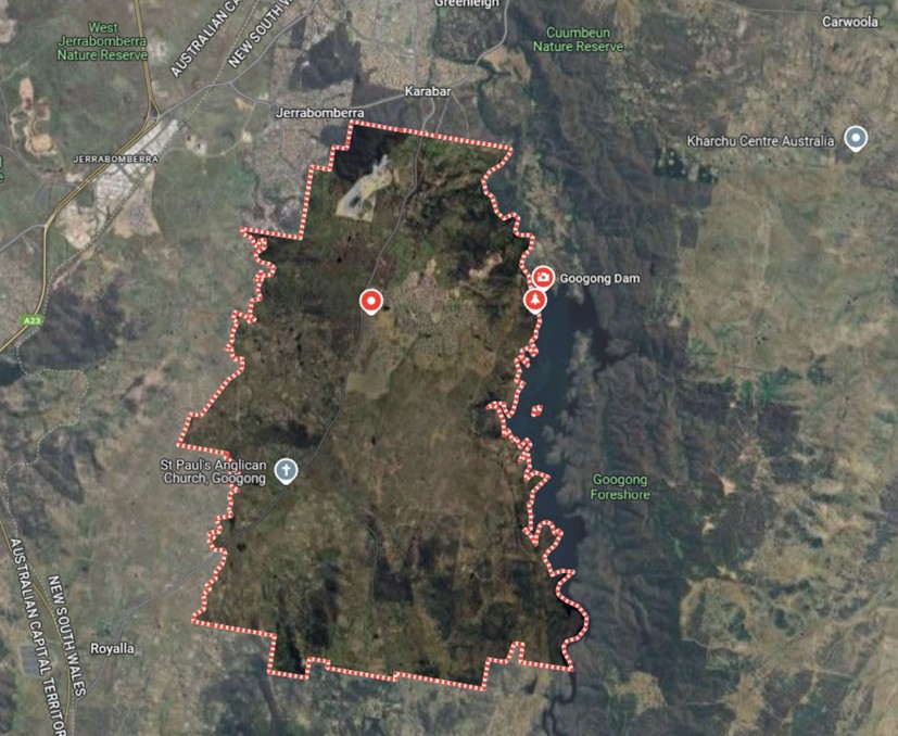
The suburb boundary is located along property boundaries and Wickerslack Lane to the north and property boundaries to the south. Property boundaries and Jerrabomberra Creek form the western boundary. Queanbeyan River forms the entire boundary to the east.
The Old Cooma Road stretches across the centre of the suburb (north-south) with Burra Road and Cooke Drive also connecting to the southern portion. Fernleigh Drive, Googong Road and Wellsvale Drive provide east and west connections to provide local road networks throughout Googong.
The southern portion of the suburb is primarily rural land holdings and vegetated rural residential properties found throughout. The centre contains an increased density in proximity to the Googong Town Centre, which also provides for the urban area of Jerrabomberra adjoining the suburb. Much of the eastern area remains dedicated to green space, bushland, and environmental reserves that form part of the wider Googong Foreshores and conservation corridor.
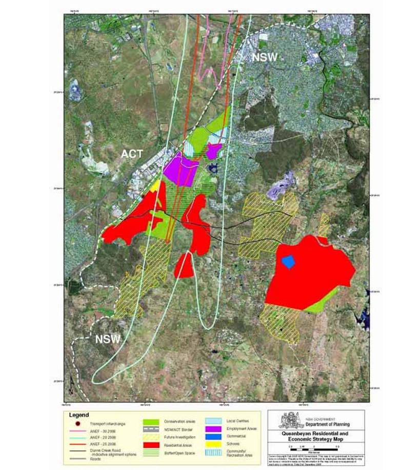
Googong Independent Queanbeyan Land Release Inquiry Findings
The NSW Minister for Planning, Hon. Frank Sartor, released the findings on 1 September 2006 of the Independent Queanbeyan Land Release Inquiry, recommending CIC Australia's Googong development as the primary future residential growth area for Queanbeyan.
Googong is a proposed master planned town with:
7,000 homes
Retail, commercial, and community facilities
Designed to support approximately 18,000 residents
To be developed over 15–20 years
Located 4.5 km south of Queanbeyan’s current urban area
Unaffected by aircraft noise
Competing sites Tralee and the Poplars were not recommended for development due to aircraft noise concerns from Canberra International Airport.
If adopted by the government, CIC plans to accelerate rezoning and development at Googong to meet Queanbeyan’s residential land needs.
The recommendation follows five years of planning by CIC and is seen as a major success by the company’s board.
Googong Residential and Economic Strategy Review 2031
The Queanbeyan Residential and Economic Strategy 2031 was officially endorsed in November 2008 and has since guided key land use planning decisions, including the development of the Queanbeyan Local Environmental Plan 2012 (QLEP 2012).
Original Strategy Objectives:
Plan for 10,000 new dwellings.
Provide 130 hectares of employment land.
Ensure a balance between residential growth, employment, conservation, open space, and community facilities.
Support Queanbeyan’s development over a 25-year horizon.
The revised Queanbeyan Residential and Economic Strategy was adopted by Council in December 2015 and endorsed by the NSW Department of Planning and Environment. It now serves as the foundational framework for urban release planning and future development in the former Queanbeyan Local Government Area.
Key Focus Areas:
Providing sufficient housing and employment land to support growth over the next 15 years.
Identifying and protecting areas with environmental constraints from development.
Googong Development Control Plan (GDCP) 2010
The Googong Development Control Plan (GDCP) provides the planning and design framework for the development of the Googong township, guiding both natural area protection and built form outcomes to support the vision of a vibrant, livable community.
Key Features:
Based on the Googong Master Plan, developed by Queanbeyan City Council using CIC Australia's plan.
Prepared in line with Clause 6.3 of the Queanbeyan Local Environmental Plan 2012 (QLEP 2012), which requires a DCP before development consent can be granted in Googong.
Sets out urban design guidelines, land use controls, and objectives to shape future growth.
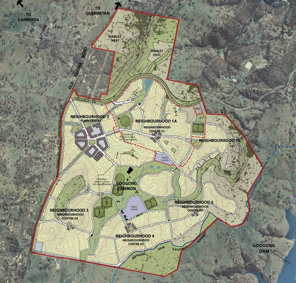
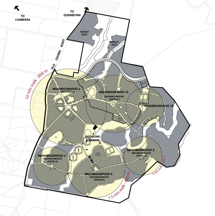
Googong Master Plan
The Googong Master Plan, developed by Queanbeyan City Council, outlines the long-term development vision for Googong over a 25-year period. It forms the foundation of the Googong Development Control Plan (DCP) and is supported by a Staging Plan and Infrastructure Plan.
Key Features:
Envisions five walkable neighbourhoods surrounding a central parkland, the “Googong Common”, plus two low-density neighbourhoods north of Googong Dam.
Defines locations for commercial centres, schools, open spaces, and transport networks.
Promotes a transition in density from low-density residential edges to higher-density mixed-use centres and a highly urban town centre.
Objectives:
Develop high-quality, sustainable neighbourhoods.
Create gradual density transitions across the township.
Ensure interconnected and safe transport options (pedestrian, cycling, vehicular).
Center each neighbourhood around a community and retail hub.
Build a diverse open space network for various recreational and civic uses.
Support social, cultural, and economic needs for both residents and visitors.
Googong - Queanbeyan Local Environmental Plan 2012
The Queanbeyan Local Environmental Plan 2012 (QLEP 2012) was gazetted on 23 November 2012 and is the planning document developed by the Queanbeyan-Palerang Regional Council in New South Wales (NSW), Australia. It provides the planning framework for land use and development within the Queanbeyan area.
Key Purposes of the QLEP 2012:
Determines what types of development with set zones
Sets limits for building height, floor space ratio, lot size, etc.
Identifies and protects heritage items and areas.
Includes provisions to protect sensitive natural areas like rivers, creeks, and bushland.
Coordinates development with roads, transport, and utility services.
Googong - Queanbeyan Development Control Plan (DCP) 2012
This Development Control Plan (DCP) has been prepared in accordance with the Environmental Planning and Assessment Act 1979 and the Environmental Planning and Assessment Regulation 2000.
The DCP is designed to support the provisions of the Queanbeyan Local Environmental Plan 2012 (QLEP 2012) by offering a clear, structured, and concise set of guidelines. It replaces the multiple DCPs that previously applied, streamlining development controls across the area.
The development standards and guidelines within this DCP represent the preferred approach to development form and location. However, Council may consider variations where alternative solutions are proposed and deemed acceptable. The DCP has been updated over the years, with the recent version published on 14 November 2022 to reflect the Queanbeyan-Palerang Regional Local Environmental Plan 2022 (QPRLEP 2022) was gazetted on 2 May 2025.
Googong Local Strategic Planning Statements (LSPS) - March 2018
In March 2018, the NSW Government introduced a requirement for all councils to develop Local Strategic Planning Statements (LSPS).
Purpose of LSPS:
Outline a 20-year land-use vision for the local area.
Identify unique local characteristics and identity.
Reflect community values to be preserved and enhanced.
Guide how growth and change will be sustainably managed.
Given the region's status as one of the fastest-growing LGAs in regional NSW, having a clear, strategic vision is essential to balancing growth with the preservation of valued community and environmental assets.
This document outlines that the Googong DCP had adopted a masterplan for the development of Googong township. This masterplan includes six residential and two rural residential neighbourhoods, commercial centres, the major open spaces areas, natural areas and connector roads. It is regularly reviewed as part of the development of each neighbourhood.
Googong Queanbeyan-Palerang Regional Local Environmental Plan 2022
The Queanbeyan-Palerang Regional Local Environmental Plan 2022 commenced on 14 November 2022 to unify and standardise land-use planning controls across the Queanbeyan-Palerang Regional LGA following the 2016 council amalgamations.
Key points:
Consolidates planning rules from former councils into one comprehensive LEP.
Aims to resolve inconsistencies, particularly in zoning and permissible uses.
Uses previous LEPs as a foundation for new standards and provisions.
Marks the first step in a broader planning overhaul, with future updates to DCPs and contribution plans also planned.
Googong Suburb Summary
Reviews & Comments on Winona Estate - Googong
Estate Brochure, Masterplan, Engineering Plan, Plan of Subdivision (POS), Design Guidelines
FAQs about Winona Estate - Googong
View all estates from Bronte Group
- The Anglican School Googong - 941m east
- Googong Public School - 1.4km east
- Jerrabomberra Public School - 4.8km north-west
- Jerrabomberra High School - 5.6km north-west
- Tirriwirri School - 6.5km north
- Queanbeyan South Public School - 6.5km north
Popular Estates near Winona Estate - Googong
Latest New Home Articles for You

19/Aug/2025 | OpenLot.com.au
🏡 Suburb Profile: Beveridge
19/Aug/2025 | OpenLot.com.au
test
19/Aug/2025 | OpenLot.com.au
tests

13/Jun/2025 | OpenLot.com.au
Display Homes at Playford Alive Estate: A Thriving Community at the Heart of Munno Para
Welcome to Playford Alive, a vibrant and dynamic masterplanned community ...

11/Jun/2025 | OpenLot.com.au
Display Homes at Ocean Hill Estate: A Thriving Community by the Coast
A short stroll from the white sands of Madora Beach and fringed by the co...

10/Jun/2025 | OpenLot.com.au
Display Homes at Bluestone Estate: An Established Community in the Mount Barker
Whether you’re a first home buyer, a growing family, or looking to downsi...

09/Jun/2025 | OpenLot.com.au
Queensland Leads, But NSW and VIC Fall Behind, in New Housing Buyer Demand Index
New data reveals that Australia’s new housing market remains resilient de...

06/Jun/2025 | OpenLot.com.au
Display Homes at Minters Fields Estate: A Scenic Hillside Community in Mount Barker
Nestled in the heart of Mount Barker, Minters Fields offers a truly remar...

03/Jun/2025 | OpenLot.com.au
🏡 Step Inside a Frenken Home at Smiths Lane
During a recent visit to the Smiths Lane display village, OpenLot.com.au ...