Rowes Lane Village - Wallan IN PLANNING
This information is estimated by the OpenLot research team. Let us know here to provide up-to-date information about this development.
| Total new homes | N/A |
| Area size | 19.80 hectares |
| Growth Region | Melbourne North Growth Corridor |
| City council | Mitchell Shire Council |
| Developer | N/A |
| Distance to | Melbourne Airport - 30 km north Melbourne CBD - 45 km north |
Land for Sale, House and Land Packages:
Popular Estates near Rowes Lane Village - Wallan


 4
4  2
2  2
2


Updates for Rowes Lane Village - Wallan
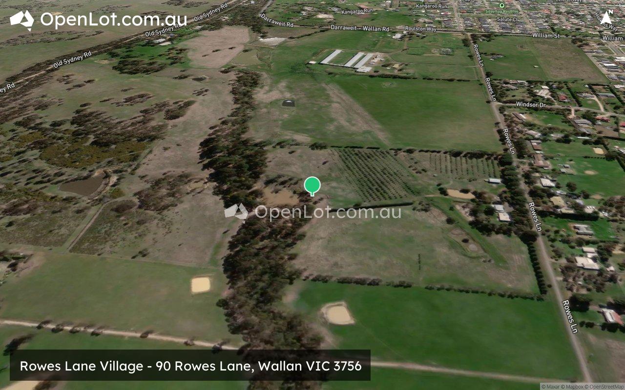
Location & Map for Rowes Lane Village - Wallan
Visit Display Homes near Rowes Lane Village - Wallan


Land Price Trend in Wallan VIC 3756
- In Oct - Dec 24, the median price for vacant land in Wallan VIC 3756 was $390,000. *
- From Oct - Dec 17 to Oct - Dec 24, the median price for vacant land in Wallan VIC 3756 has increased 81.4%. *
- From 2008 to 2024, the median price for vacant land in Wallan VIC 3756 has increased 142.68%. *
Schools near Rowes Lane Village - Wallan
Here are 6 schools near Rowes Lane Village - Wallan:
Prep-6 Government Primary School
7-12 Government Secondary School
Prep-6 Catholic Primary School
Prep-6 Government Primary School
Prep-6 Government Primary School - School Head Campus
Prep-6 Government Primary School
Reviews & Comments on Rowes Lane Village - Wallan
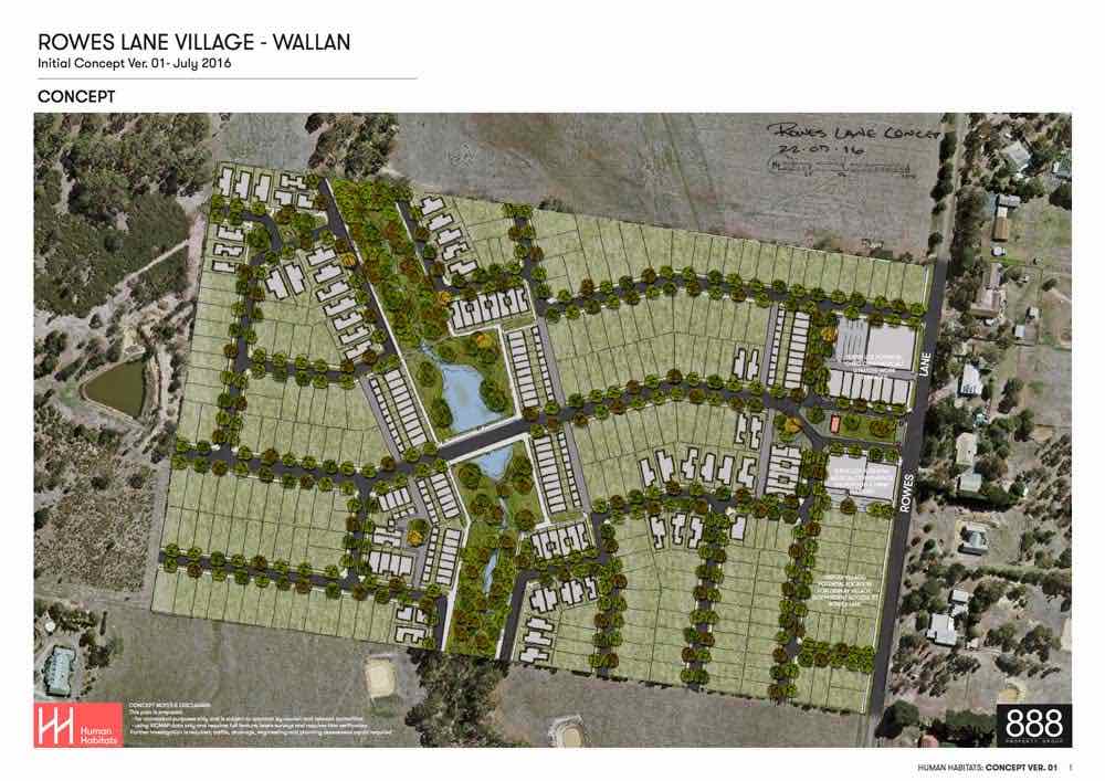
Estate Brochure, Masterplan, Engineering Plan, Plan of Subdivision (POS), Design Guidelines
FAQs about Rowes Lane Village - Wallan
- Wallan Primary School - 1.7km east
- Wallan Secondary College - 2.3km east
- Our Lady of the Way Catholic Primary School - 4.1km east
- Darraweit Guim Primary School - 5.7km west
- Beveridge Primary School - 6.8km south
- Wandong Primary School - 8.6km north-east
Popular Estates near Rowes Lane Village - Wallan
Latest New Home Articles for You

19/Aug/2025 | OpenLot.com.au
🏡 Suburb Profile: Beveridge
19/Aug/2025 | OpenLot.com.au
test
19/Aug/2025 | OpenLot.com.au
tests

13/Jun/2025 | OpenLot.com.au
Display Homes at Playford Alive Estate: A Thriving Community at the Heart of Munno Para
Welcome to Playford Alive, a vibrant and dynamic masterplanned community ...

11/Jun/2025 | OpenLot.com.au
Display Homes at Ocean Hill Estate: A Thriving Community by the Coast
A short stroll from the white sands of Madora Beach and fringed by the co...

10/Jun/2025 | OpenLot.com.au
Display Homes at Bluestone Estate: An Established Community in the Mount Barker
Whether you’re a first home buyer, a growing family, or looking to downsi...

09/Jun/2025 | OpenLot.com.au
Queensland Leads, But NSW and VIC Fall Behind, in New Housing Buyer Demand Index
New data reveals that Australia’s new housing market remains resilient de...

06/Jun/2025 | OpenLot.com.au
Display Homes at Minters Fields Estate: A Scenic Hillside Community in Mount Barker
Nestled in the heart of Mount Barker, Minters Fields offers a truly remar...

03/Jun/2025 | OpenLot.com.au
🏡 Step Inside a Frenken Home at Smiths Lane
During a recent visit to the Smiths Lane display village, OpenLot.com.au ...