


Ooranya Estate - Beveridge 18 AVAILABLE
[LIMITED OFFER] $35,000 Rebate Available on Selected Lots For Limited Time Only!
- Coming Soon! New Land Release
- Visit our office today. Located - 36 Whiteside Street, Beveridge
- Larger-than-average block sizes of up to 600 square metres.
- We have Display Homes for Sale
- Turnkey options available with 6 star energy rating
- No Body Corporate Fees
- An environmentally friendly community with recycled water in each home and high-speed internet NBN
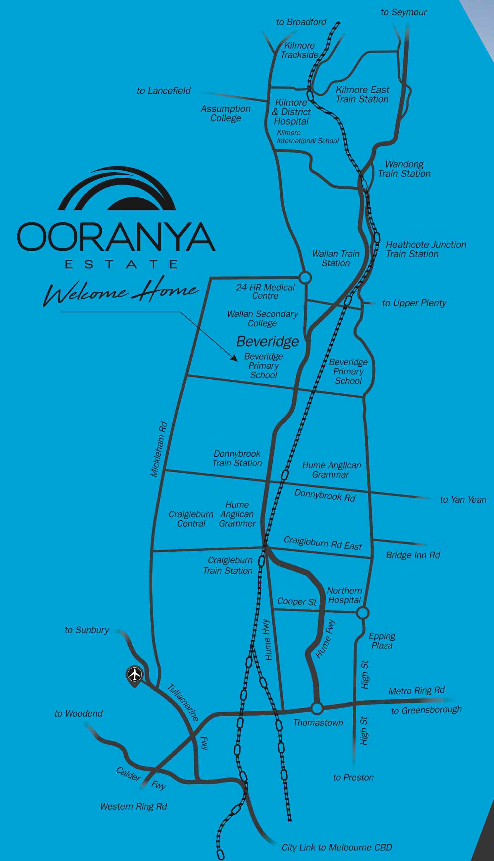
- 45-minute train ride into Melbourne’s CBD
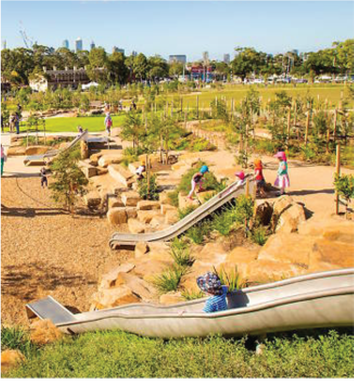
- 1.5 hectare green park, ideal environment with plenty of fresh air for family.
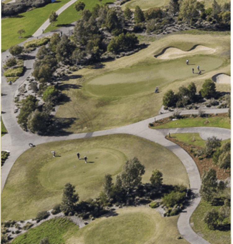
- Next to the Mandalay Golf Course
- Near educational facilities and further shopping precincts.
- Doorstep to some of the region’s best wineries, stunning parks, shopping centres, and enough space to raise a family and kick a footy.
- A short drive to the Hume Freeway, which can head to the charming townships of Wallan, Kilmore and Mickleham.
- Easy access to the historic towns of Heathcote and Kinglake
- Wallan train station that shoots commuters into the CBD in 35 minutes
This information is estimated by the OpenLot research team. Let us know here to provide up-to-date information about this development.
| Total new homes | 2,500 |
| Area size | N/A |
| Growth Region | Melbourne North Growth Corridor |
| City council | Mitchell Shire Council |
| Developer | N/A |
| Project marketer | Bevan Projects |
| Distance to | Melbourne Airport - 24 km north-east Melbourne CBD - 38 km north |
Land for Sale, House and Land Packages:
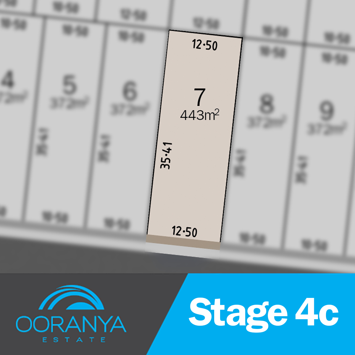
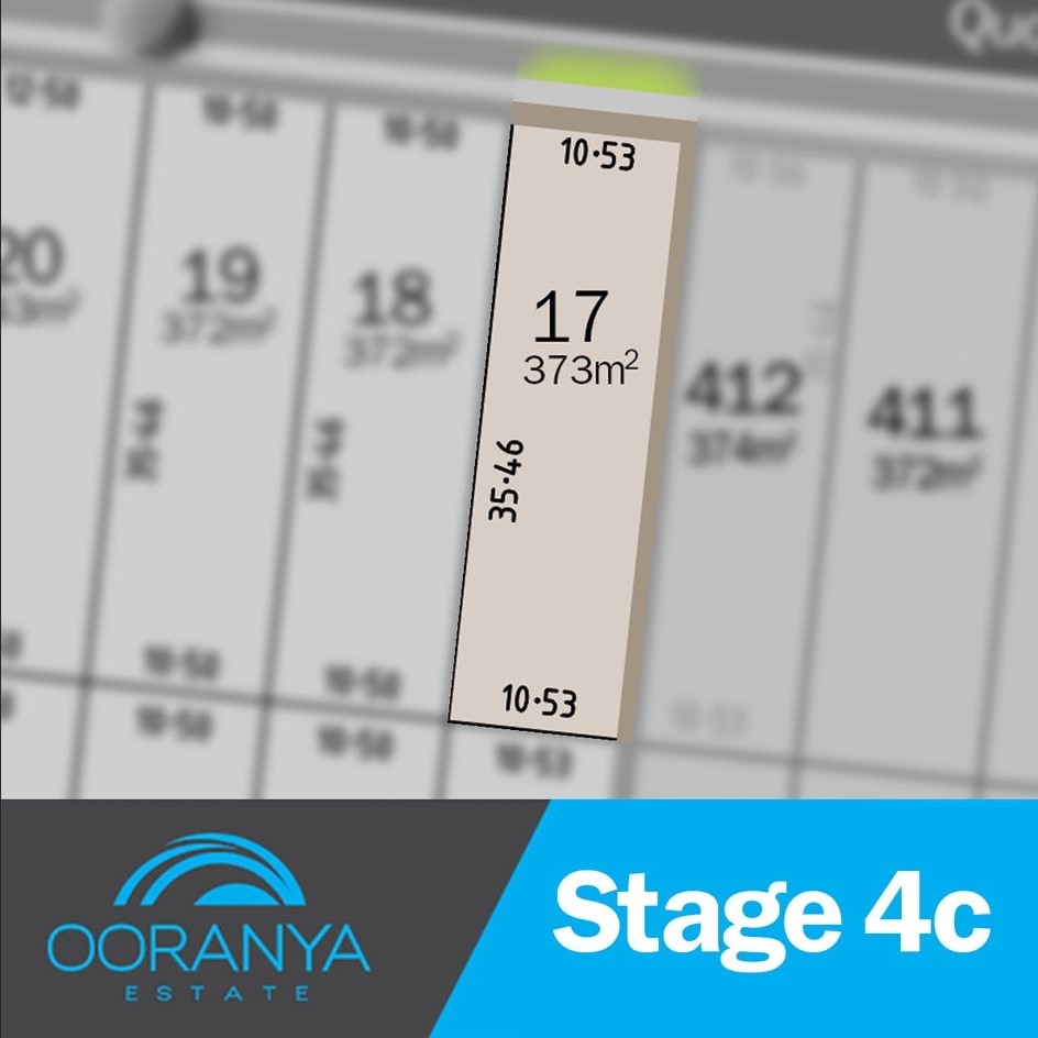
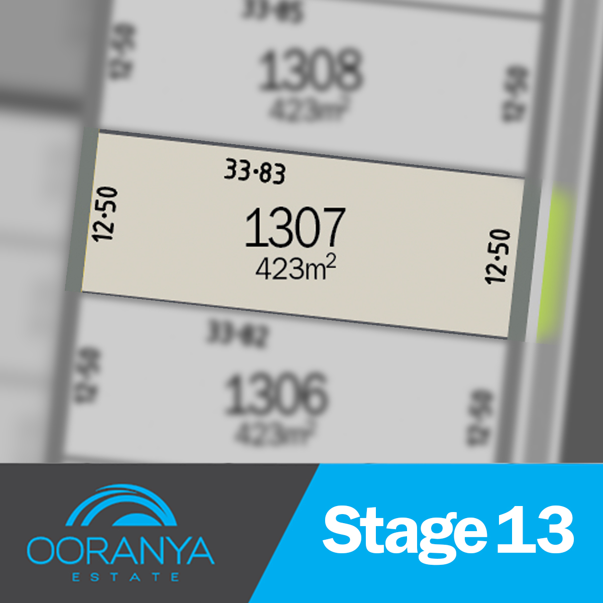
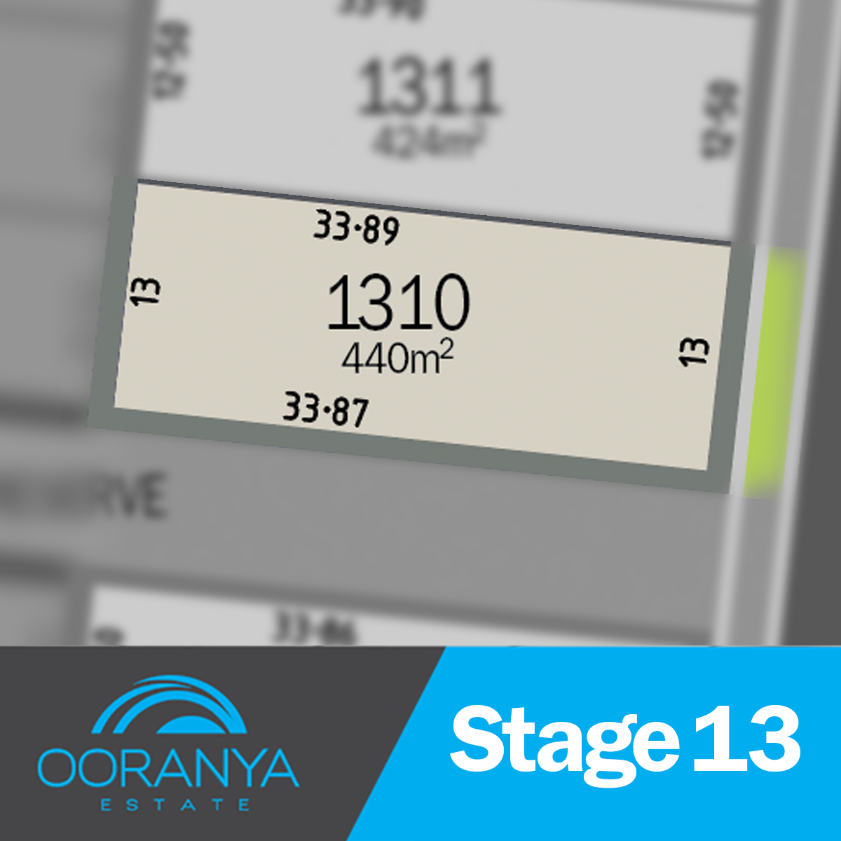
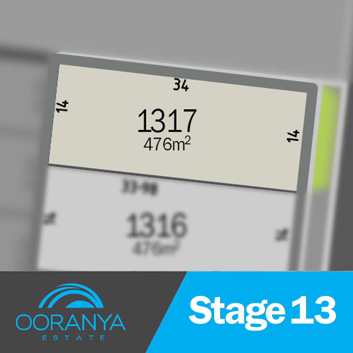
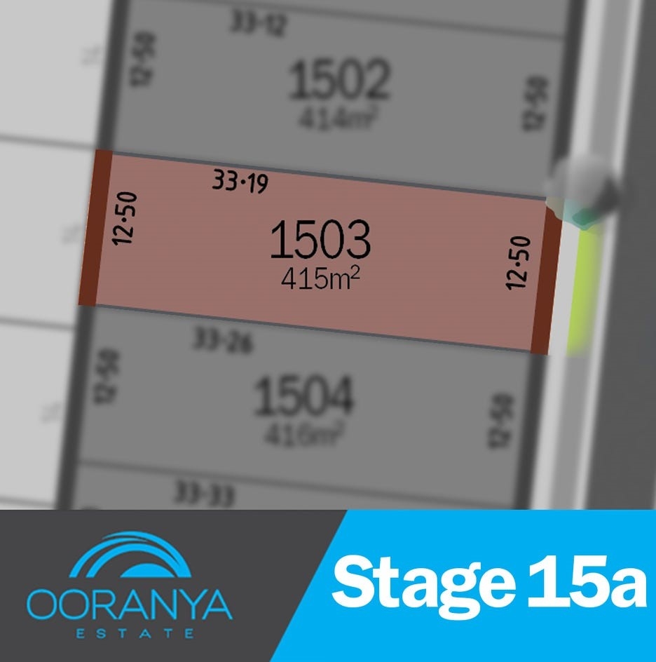
11 Land Lots in Ooranya Estate - Beveridge
Residents are near wineries, hiking trails, and the Mandalay Golf Course. The Wallan train gets you to Melbourne's CBD in 35 minutes, with plans for a new station in Beveridge. Enjoy a balanced lifestyle in this charming community.
Residents are near wineries, hiking trails, and the Mandalay Golf Course. The Wallan train gets you to Melbourne's CBD in 35 minutes, with plans for a new station in Beveridge. Enjoy a balanced lifestyle in this charming community.
Residents are near wineries, hiking trails, and the Mandalay Golf Course. The Wallan train gets you to Melbourne's CBD in 35 minutes, with plans for a new station in Beveridge. Enjoy a balanced lifestyle in this charming community.
Residents are near wineries, hiking trails, and the Mandalay Golf Course. The Wallan train gets you to Melbourne's CBD in 35 minutes, with plans for a new station in Beveridge. Enjoy a balanced lifestyle in this charming community.
Residents are near wineries, hiking trails, and the Mandalay Golf Course. The Wallan train gets you to Melbourne's CBD in 35 minutes, with plans for a new station in Beveridge. Enjoy a balanced lifestyle in this charming community.
Residents are near wineries, hiking trails, and the Mandalay Golf Course. The Wallan train gets you to Melbourne's CBD in 35 minutes, with plans for a new station in Beveridge. Enjoy a balanced lifestyle in this charming community.
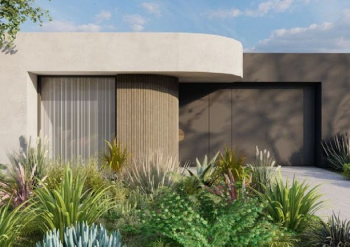
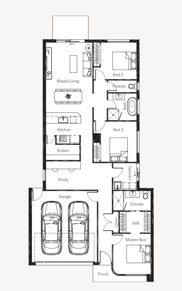
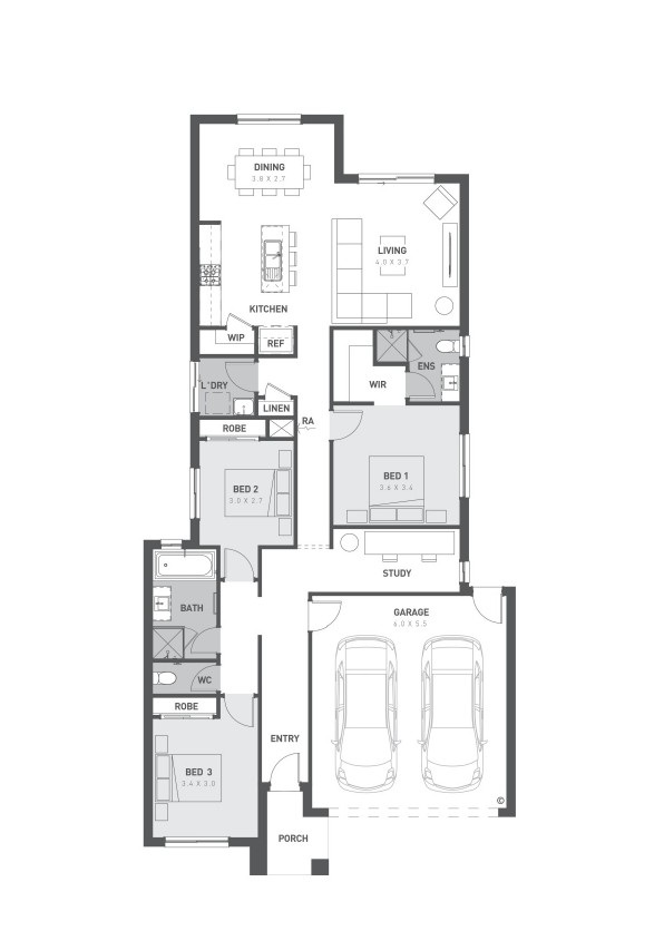
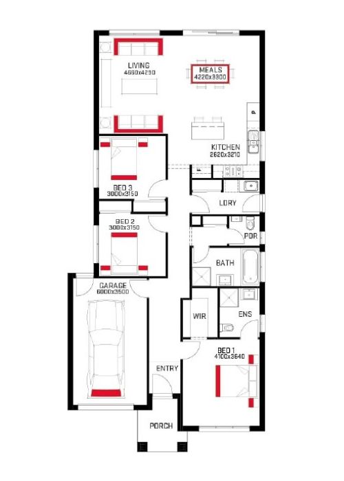
15 House and Land Packages in Ooranya Estate - Beveridge

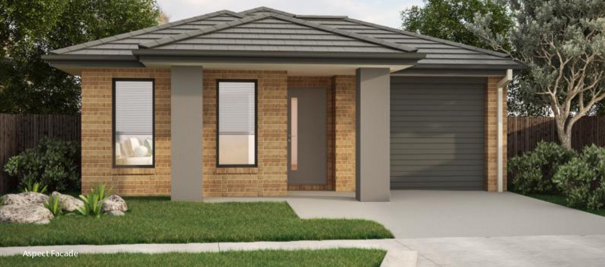

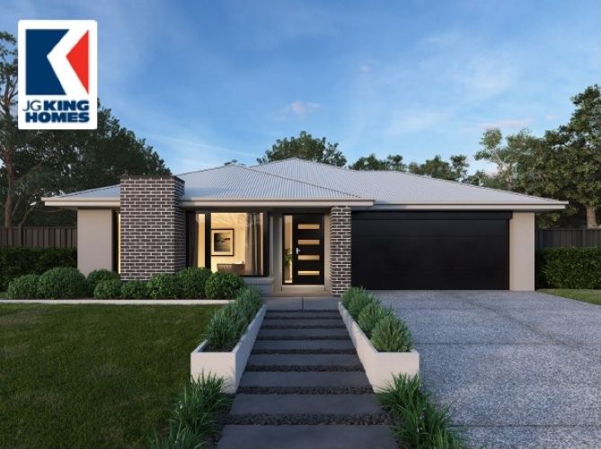
3 Display Homes in Ooranya Estate Display Village - Beveridge

 4
4 2.5
2.5 1
1 2 4 2 1 2
Updates for Ooranya Estate - Beveridge
Facebook updates:
Related news:

Nestled in the charming town of Beveridge, Ooranya is a community designed for those seeking the ideal balance between serene country living and modern urban conveniences. As soon as you step through your front door in this welcoming community, you'll feel the warmth and comfort of a place that truly feels like home.

As Victoria's property market continues to evolve, buyers are keen to secure prime real estate in the state's most sought-after growth corridors. According to data from OpenLot.com.au, the following estates have emerged as the top five in each region based on buyer interest in January 2025.

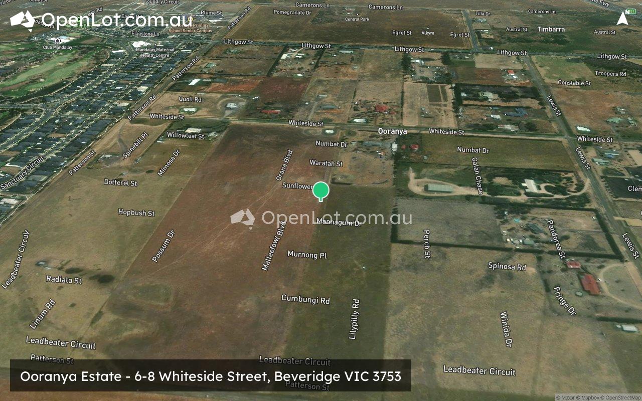
6-8 Whiteside Street, Beveridge, Vic 3753. View property details and sold price of 6-8 Whiteside Street & other properties in Beveridge, Vic 3753.
Missing articles? Send us a link here.
Location & Map for Ooranya Estate - Beveridge
Land Price Trend in Beveridge VIC 3753
- In Oct - Dec 24, the median price for vacant land in Beveridge VIC 3753 was $330,000. *
- From Oct - Dec 17 to Oct - Dec 24, the median price for vacant land in Beveridge VIC 3753 has increased 14.98%. *
- From 2008 to 2024, the median price for vacant land in Beveridge VIC 3753 has increased 215.5%. *
Vacancy Rate in Beveridge VIC 3753
View full vacancy rate history in Beveridge VIC 3753 via SQM Research.
Schools near Ooranya Estate - Beveridge
Here are 6 schools near Ooranya Estate - Beveridge:
Prep-6 Government Primary School - School Head Campus
Prep-6 Government Primary School
7-12 Government Secondary School
Prep-6 Catholic Primary School
Prep-6 Government Primary School
Prep-6 Government Primary School
Suburb Planning Review in Beveridge VIC 3753
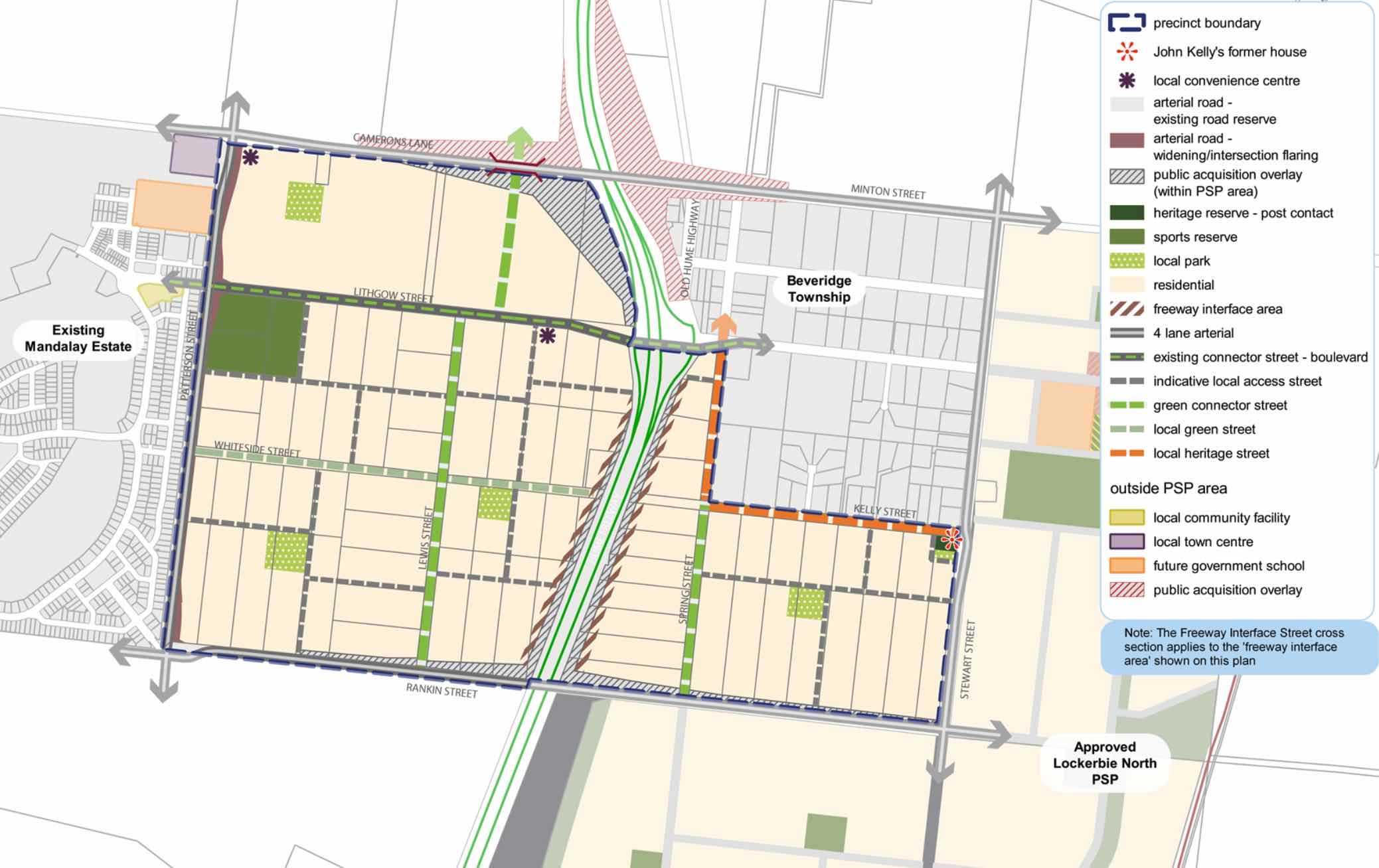
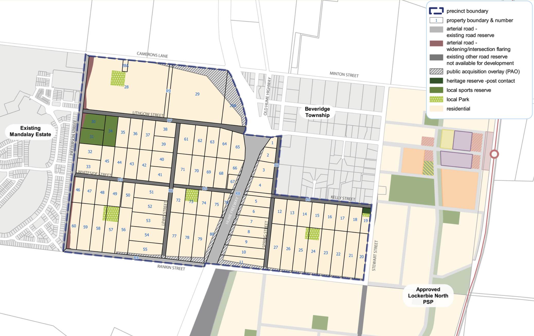
Beveridge is within the Mitchell Shire, located 42 kilometres north of Melbourne and the rural-residential township forms part of the Urban Growth Boundary. The Beveridge growth area is approximately 291.97ha, which is located to the south and west of the existing Beveridge Township on either side of the Hume Highway.
The new suburb is bounded by the existing Mandalay Estate (Patterson Street) to the west, Camerons Lane to the north, Beveridge Township to the north east, Rankin Street to the south and Stewart Street to the east.
The Beveridge Central Precinct Structure Plan (PSP) was prepared to guide the redevelopment of two future neighbourhoods separated by the Hume Freeway to provide residential neighbourhoods linked by a network of pathways that connect local parks, reserves and convenience centres.
The eastern side of the Hume Highway will integrate with the existing Beveridge Township and the western side will be connected to the existing Mandalay estate and future precincts of Beveridge North-West and Beveridge South-West.
Beveridge also has a current investigation area to the North West of the existing township. The Victorian Planning Authority (VPA) is preparing a draft Beveridge North West Precinct Structure Plan to introduce the amendment into the Mitchell Planning Schemes. The aim is to have the final decision on the PSP shared publicly by August 2022.
The Beveridge Central PSP was prepared by Victorian Planning Authority (VPA) in consultation with the Whittlesea City Council and Mitchell Shire Council and was approved by the Minister for Planning in December 2018. The decision was officially gazetted in January 2019 under Amendment GC55 to the Mitchell and Whittlesea Planning Schemes.
The Vision of Beveridge
“Beveridge Central is a precinct that builds upon the existing sense of community and history of the Beveridge Township while reinforcing its social and physical connections to newer development occurring in this part of the North Growth Corridor”.
“Beveridge Central is expected to change from a rural-residential community into a well serviced, urban community defined by two future neighbourhoods bisected by the Hume Freeway. The eastern side will have a strong relationship with the existing Beveridge Township and development in the Lockerbie North precinct; the western side connecting to the future Beveridge North-West and Beveridge South-West precincts and existing Mandalay estate. There is a focus on creating a high amenity landscape character by featuring extensive landscaping opportunities and green streets within the existing wide road reserves”.
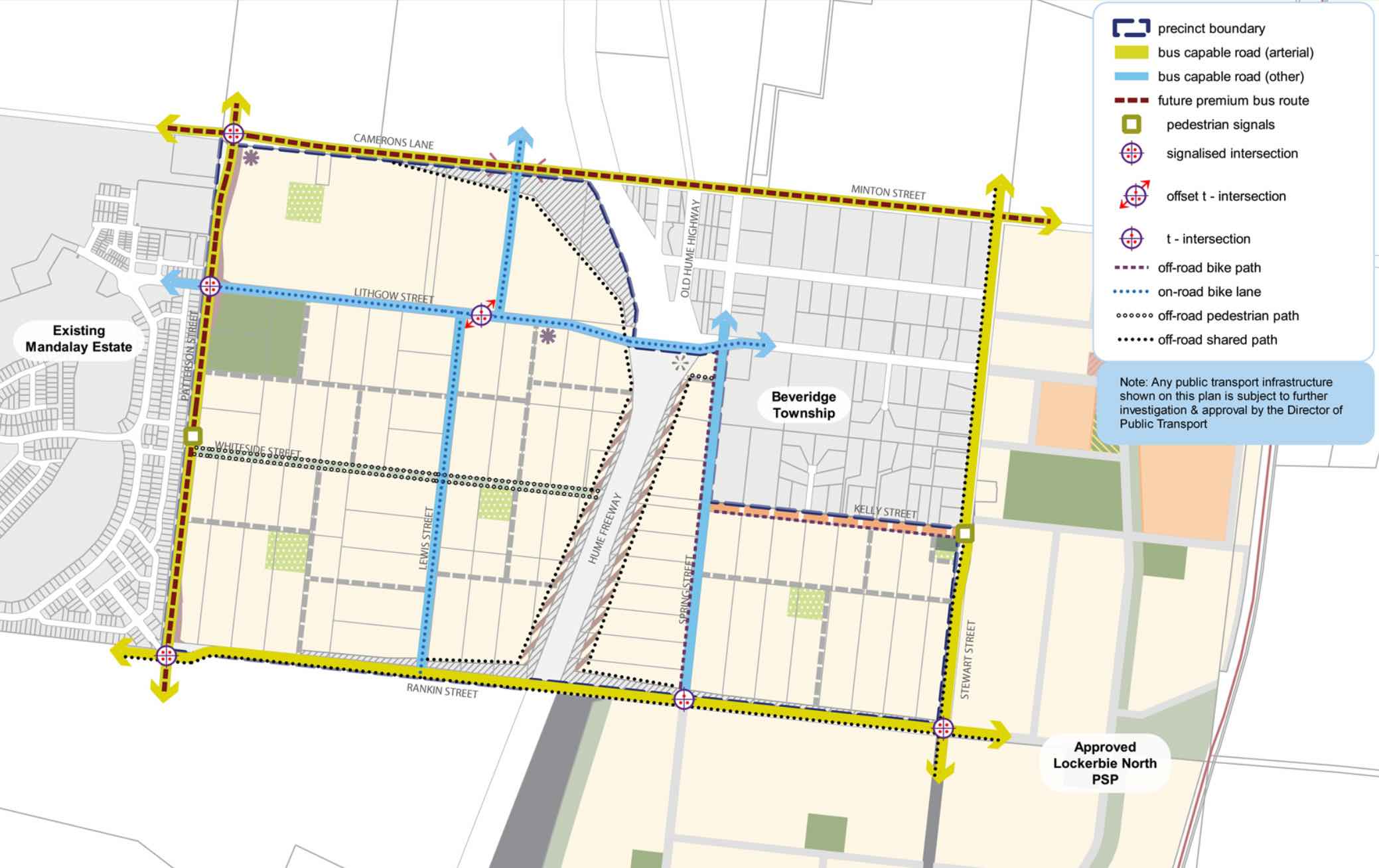
“A cycling and pedestrian path network along streets will connect key destinations such as local parks, the sporting reserve and convenience centres. Highlighting the precinct’s heritage features provides a sense of place for future residents through the preservation and enhancement of Aboriginal and post-contact heritage places and provides mechanisms to ensure the ongoing protection of these places”.
“To service the needs of future residents the precinct will be connected to social and community infrastructure in immediate neighbouring areas. The neighbourhood infrastructure needs of the community will be largely met within the precinct itself, with high quality open spaces and a sports field. Shopping and commercial services will be readily accessible immediately adjacent to the precinct in new town centres in Mandalay and Lockerbie North, with small scale retail needs provided by two local convenience centres within the precinct”.
“In the longer term, the precinct will be accessible to higher-order services, shopping and jobs at the Beveridge Major Town Centre to the southeast of the precinct. Beveridge Central Precinct will have strong transport connections to key destinations via the Hume Freeway, a potential new railway station at Beveridge, and the future Outer Metropolitan Ring (OMR) road, approximately 2km to the south”.
Benefits of Beveridge
The existing zoning will be amended to provide for Urban Growth Zones, providing a series of local parks in proximity to new residential areas and two local convenience centres. The surrounding precincts will provide social, retail and community infrastructure for the new community.
Local shopping, services and employment will be provided within the Beveridge Major Town Centre found in the Beveridge South-West precinct and key industrial employment opportunities within the Northern Corridor.
The Precinct Structure Plan supports the new residential community, protection of heritage places and facilitates the future setbacks for the Hume Highway upgrade.
.jpeg)
Transportation in Beveridge
Beveridge will be connected to public passenger transport, with a future train station to be built in Lockerbie, located to the east outside the Beveridge Township boundary. The passenger train service connects Melbourne to Sydney and is being considered for a high speed rail project.
The suburb will include a network of shared paths, linking the local parks and a new road network. Land acquisition is provided to Camerons Lane and Rankin Street to facilitate intersection upgrades to the Hume Highway, providing a direct connection to Melbourne CBD or northern Victoria.
Beveridge Suburb Summary
| Suburb | Beveridge, Mitchell Shire |
| City / State | Melbourne, Victoria |
| Suburb Area | 291.97ha |
| Boundary |
|
| Suburb inclusions |
|
| Community Amenity | Heritage area and general residential area, with local parks |
| Location | North Melbourne, 42 km from Melbourne CBD |
| Education | None |
| Types of Residential |
|
| Employment Areas | Retail and Commercial, Schools, Community Centre |
| Infrastructure |
|
| Transportation |
|
| Recreation Areas |
|
| Heritage |
|
| Settlement Pattern | Green Field |
References
- Mitchell Shire Council
- Victoria Planning Authority – Planning Schemes
- Victoria Planning Authority
- Victoria Planning Authority – Beveridge Central PSP
Reviews & Comments on Ooranya Estate - Beveridge
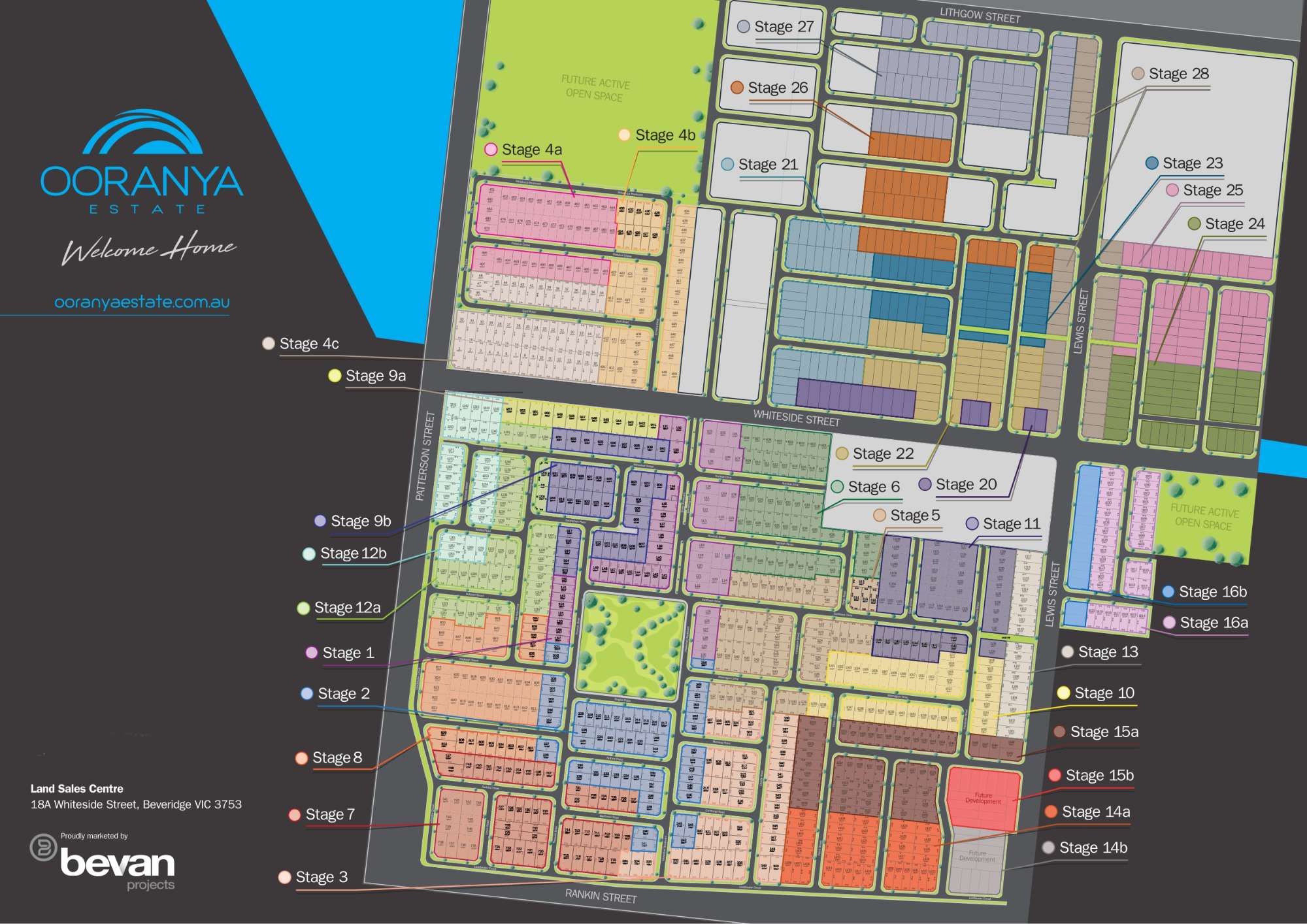
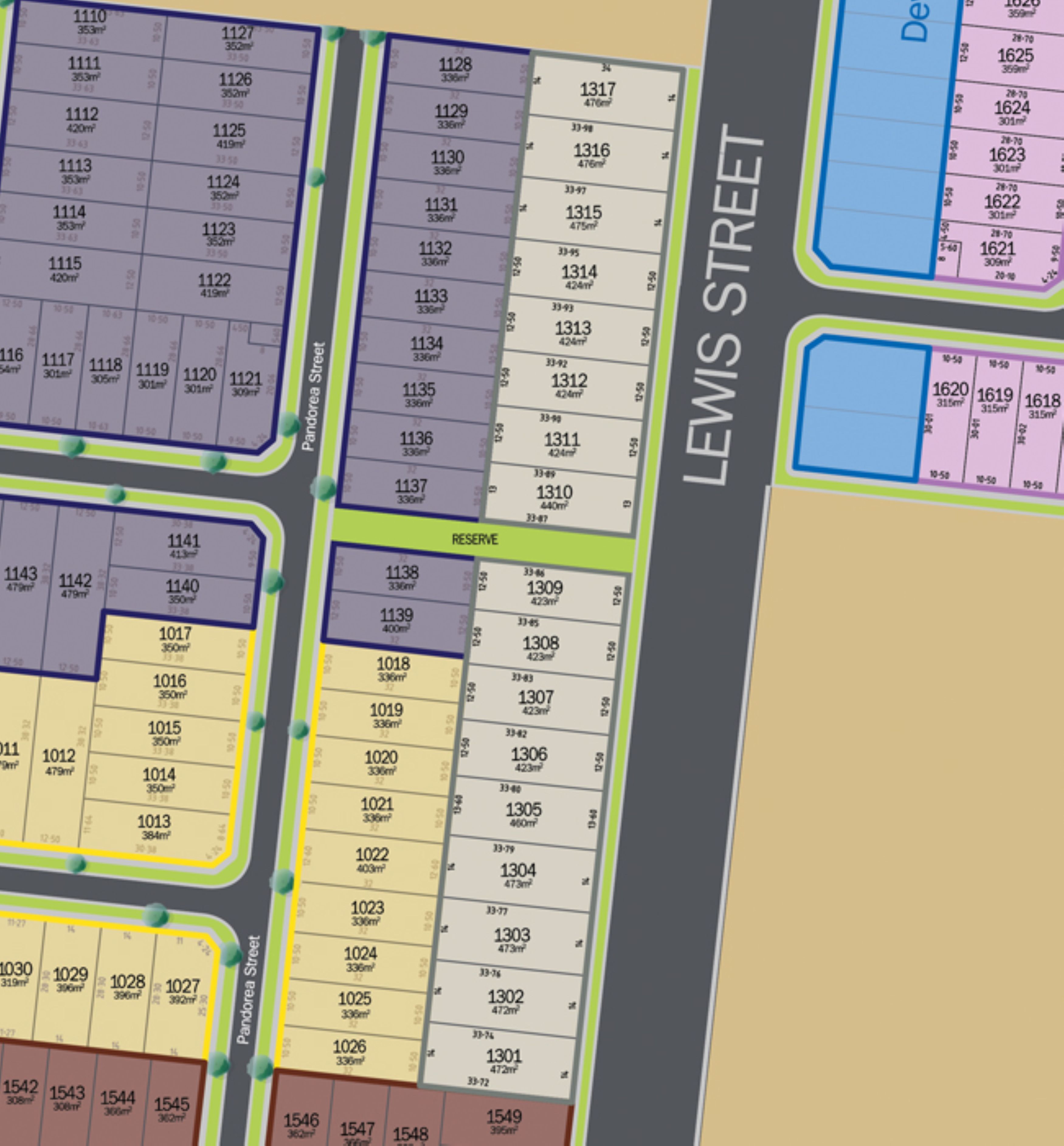
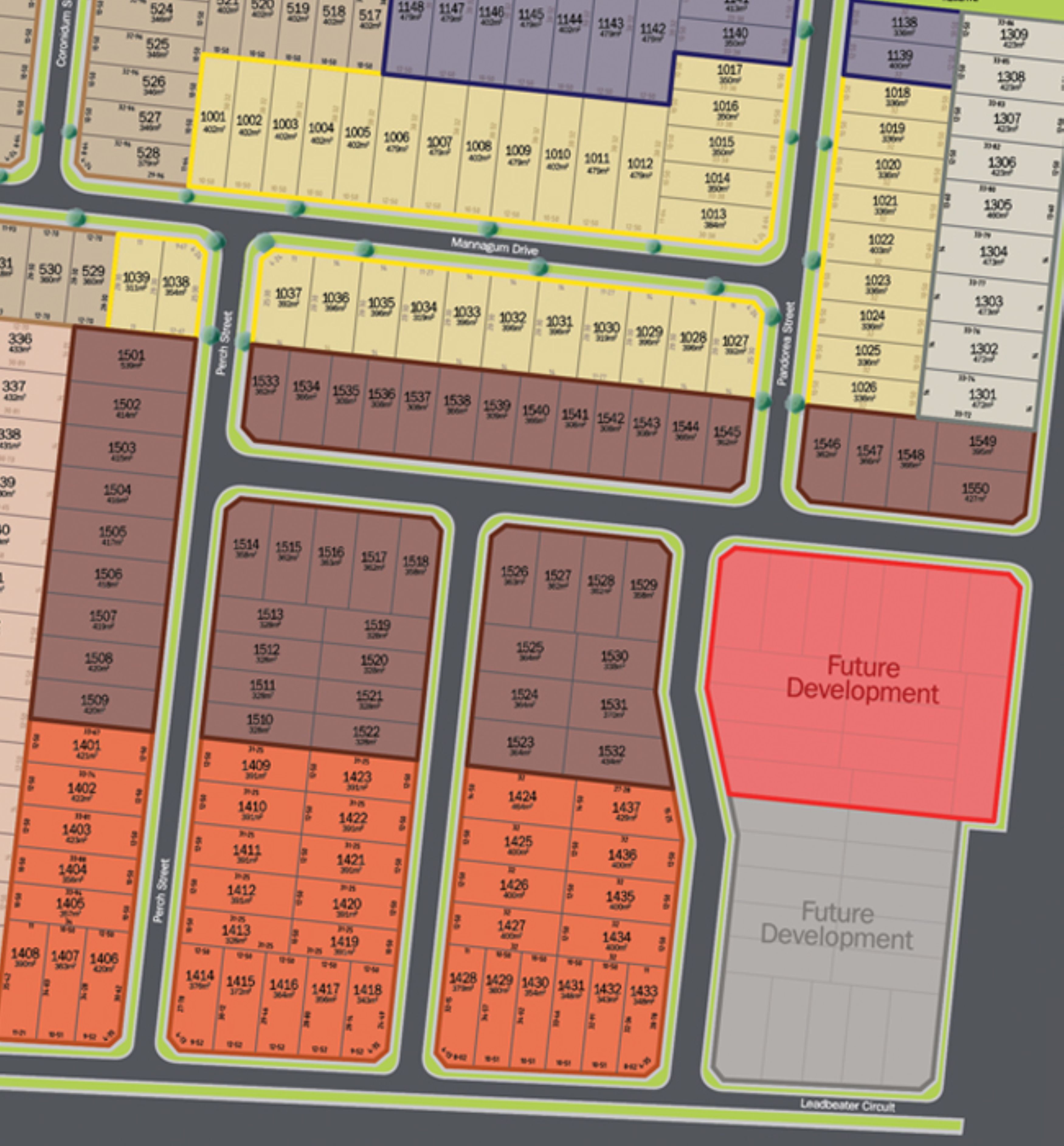
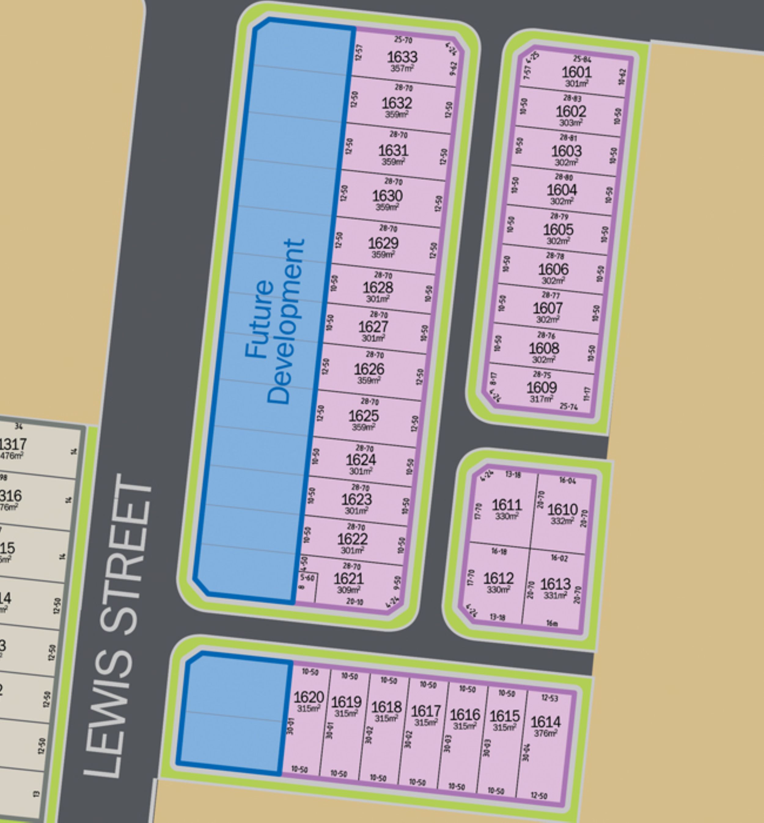
Estate Brochure, Masterplan, Engineering Plan, Plan of Subdivision (POS), Design Guidelines
FAQs about Ooranya Estate - Beveridge
View all estates marketed by Bevan Projects
- Beveridge Primary School - 1.7km north-east
- Gilgai Plains Primary School - 6.0km south
- Wallan Secondary College - 6.9km north
- Our Lady of the Way Catholic Primary School - 7.0km north-east
- Gaayip-Yagila Primary School - 7.2km south-west
- Donnybrook Primary School - 7.2km south-east
Popular Estates near Ooranya Estate - Beveridge


Latest New Home Articles for You

19/Aug/2025 | OpenLot.com.au
🏡 Suburb Profile: Beveridge
19/Aug/2025 | OpenLot.com.au
test
19/Aug/2025 | OpenLot.com.au
tests

13/Jun/2025 | OpenLot.com.au
Display Homes at Playford Alive Estate: A Thriving Community at the Heart of Munno Para
Welcome to Playford Alive, a vibrant and dynamic masterplanned community ...

11/Jun/2025 | OpenLot.com.au
Display Homes at Ocean Hill Estate: A Thriving Community by the Coast
A short stroll from the white sands of Madora Beach and fringed by the co...

10/Jun/2025 | OpenLot.com.au
Display Homes at Bluestone Estate: An Established Community in the Mount Barker
Whether you’re a first home buyer, a growing family, or looking to downsi...

09/Jun/2025 | OpenLot.com.au
Queensland Leads, But NSW and VIC Fall Behind, in New Housing Buyer Demand Index
New data reveals that Australia’s new housing market remains resilient de...

06/Jun/2025 | OpenLot.com.au
Display Homes at Minters Fields Estate: A Scenic Hillside Community in Mount Barker
Nestled in the heart of Mount Barker, Minters Fields offers a truly remar...

03/Jun/2025 | OpenLot.com.au
🏡 Step Inside a Frenken Home at Smiths Lane
During a recent visit to the Smiths Lane display village, OpenLot.com.au ...